Area Overview for TA3 7DX
Photos of TA3 7DX

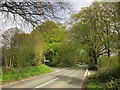
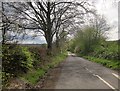
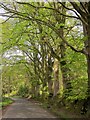
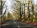
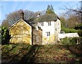
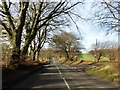
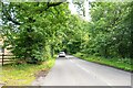
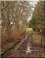
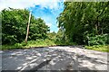
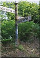
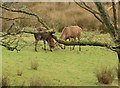
12 photos from this area
Area Information
Key information about the TA3 7DX including its size, population, and administrative classification.
- Area Type
- Postcode
- Area Size
- 1.7 km²
- Population
- 2290
- Population Density
- 44 people/km²
House Prices in TA3 7DX
35
Properties
£368,750
Average Sold Price
£160,000
Lowest Price
£755,000
Highest Price
Showing 35 properties
| Address | Type | Beds | Baths | Last Sale Price | Last Sale Date | |
|---|---|---|---|---|---|---|
| Widcombe Farm, Churchinford Road, Culmhead, Chard, TA3 7DX | Detached | - | - | £160,000 | May 2022 | |
| Highbeech Cottage, Churchinford Road, Culmhead, Chard, TA3 7DX | house | - | - | £400,000 | Jan 2020 | |
| Moor Cottage, Blackdown Hill Road, Pitminster, Taunton, TA3 7DX | Detached | 3 | 1 | £160,000 | May 2001 | |
| Widcombe House, Churchinford Road, Culmhead, Chard, TA3 7DX | Unknown | - | - | £755,000 | Jan 2001 | |
| Widcombe Grange, Churchinford Road, Culmhead, Chard, TA3 7DX | Detached | 7 | 7 | - | - | |
| Widcott, Churchinford Road, Culmhead, Chard, TA3 7DX | Detached | 3 | 1 | - | - | |
| Laurel Cottage, Churchinford Road, Culmhead, Chard, TA3 7DX | Detached | - | - | - | - | |
| 5, Otterford Caravan Site, Whitewall Road, Culmhead, Chard, TA3 7DX | Mobile Home | - | - | - | - | |
| 14, Otterford Caravan Site, Whitewall Road, Culmhead, Chard, TA3 7DX | Mobile Home | - | - | - | - | |
| 3, Otterford Caravan Site, Whitewall Road, Culmhead, Chard, TA3 7DX | Mobile Home | - | - | - | - |
Page 1 of 4
Energy Efficiency in TA3 7DX
Amenities
Schools
| Rank | School | Type | Entry gender | Ages |
|---|
Explore more schools in this area
Go to Schools tabDemographics
Household Size
Two person
most common
Accommodation Type
Houses
most common
Tenure
80
majority
Ethnic Group
White
most common
Religion
N/A
most common
Household Composition
N/A
most common
Age
47
median
Adults (30-64 years)
most common
Household Deprivation
N/A
with no deprivation
NS-SEC
41
in Lower managerial occupations
Explore more demographic insights in this area
Go to Demographics tabPlanning
Planning Constraints
- Flood RiskPremium
- Ramsar Wetland SitesPremium
- Area of Outstanding Natural BeautyPremium
- Protected Nature ReservePremium
- Protected WoodlandPremium