Area Overview for TA3 6TP
Photos of TA3 6TP
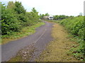
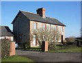
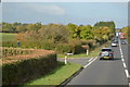


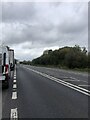
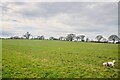

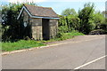
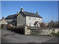
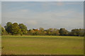
21 photos from this area
Area Information
Key information about the TA3 6TP including its size, population, and administrative classification.
- Area Type
- Postcode
- Area Size
- 27.6 hectares
- Population
- 2245
- Population Density
- 46 people/km²
House Prices in TA3 6TP
11
Properties
£280,000
Average Sold Price
£190,000
Lowest Price
£370,000
Highest Price
Showing 11 properties
| Address | Type | Beds | Baths | Last Sale Price | Last Sale Date | |
|---|---|---|---|---|---|---|
| The Parlour House, Capland Court, Hatch Beauchamp, Taunton, TA3 6TP | house | - | - | £370,000 | Mar 2013 | |
| Capland Orchard, Ilminster Road, Hatch Beauchamp, Taunton, TA3 6TP | Detached | 5 | - | £190,000 | May 1998 | |
| The Stables, Capland Court, Hatch Beauchamp, Taunton, TA3 6TP | Semi-detached | 4 | 3 | - | - | |
| 246 Capland Lane, Hatch Beauchamp, Taunton, TA3 6TP | Retail | 4 | 2 | - | - | |
| Capland Farm, Capland Lane, Hatch Beauchamp, Taunton, TA3 6TP | Detached | 5 | 3 | - | - | |
| The Byre, Capland Court, Hatch Beauchamp, Taunton, TA3 6TP | Semi-detached | 3 | - | - | - | |
| The Cider House, Capland Court, Hatch Beauchamp, Taunton, TA3 6TP | Semi-detached | - | - | - | - | |
| Orchard Park Nurseries, Capland Lane, Hatch Beauchamp, Taunton, TA3 6TP | Farm | - | - | - | - | |
| 248 Capland Lane, Hatch Beauchamp, Taunton, TA3 6TP | Semi-detached | - | - | - | - | |
| The Shippen, Capland Court, Hatch Beauchamp, Taunton, TA3 6TP | Terraced | - | - | - | - |
Page 1 of 2
Energy Efficiency in TA3 6TP
Amenities
Schools
| Rank | School | Type | Entry gender | Ages |
|---|
Explore more schools in this area
Go to Schools tabDemographics
Household Size
Two person
most common
Accommodation Type
Houses
most common
Tenure
78
majority
Ethnic Group
White
most common
Religion
N/A
most common
Household Composition
N/A
most common
Age
47
median
Adults (30-64 years)
most common
Household Deprivation
N/A
with no deprivation
NS-SEC
41
in Lower managerial occupations
Explore more demographic insights in this area
Go to Demographics tabPlanning
Planning Constraints
- Flood RiskPremium
- Ramsar Wetland SitesPremium
- Area of Outstanding Natural BeautyPremium
- Protected Nature ReservePremium
- Protected WoodlandPremium