Area Overview for TA3 6DA
Photos of TA3 6DA
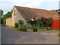
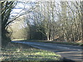


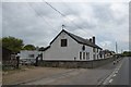
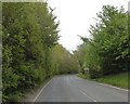
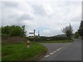
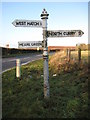
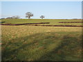
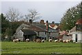
15 photos from this area
Area Information
Key information about the TA3 6DA including its size, population, and administrative classification.
- Area Type
- Postcode
- Area Size
- 60.0 hectares
- Population
- 2245
- Population Density
- 46 people/km²
House Prices in TA3 6DA
23
Properties
£416,844
Average Sold Price
£133,600
Lowest Price
£645,000
Highest Price
Showing 23 properties
| Address | Type | Beds | Baths | Last Sale Price | Last Sale Date | |
|---|---|---|---|---|---|---|
| Hedgelands, Meare Green, West Hatch, Taunton, TA3 6DA | Bungalow | 4 | 2 | £560,000 | Oct 2023 | |
| Greenfields, Meare Green, West Hatch, Taunton, TA3 6DA | Bungalow | 4 | 1 | £510,000 | Jun 2022 | |
| Briars, Meare Green, West Hatch, Taunton, TA3 6DA | Bungalow | 4 | 2 | £350,000 | Dec 2019 | |
| The Orchards, Meare Green, West Hatch, Taunton, TA3 6DA | Detached | 5 | 3 | £576,000 | Apr 2018 | |
| Meare Green House, Meare Green, West Hatch, Taunton, TA3 6DA | Detached | 4 | 2 | £400,000 | Jan 2017 | |
| Willow Cottage, Meare Green, West Hatch, Taunton, TA3 6DA | Detached | 4 | 2 | £365,000 | Jan 2015 | |
| The Cottage, Meare Green, West Hatch, Taunton, TA3 6DA | Detached | - | - | £645,000 | Aug 2008 | |
| Tee-jan, Meare Green, West Hatch, Taunton, TA3 6DA | Bungalow | 4 | 1 | £212,000 | Dec 2002 | |
| Hill View, Meare Green, West Hatch, Taunton, TA3 6DA | house | - | - | £133,600 | Oct 1998 | |
| Gaskins, Meare Green, West Hatch, Taunton, TA3 6DA | house | - | - | - | - |
Page 1 of 3
Energy Efficiency in TA3 6DA
Amenities
Schools
| Rank | School | Type | Entry gender | Ages |
|---|
Explore more schools in this area
Go to Schools tabDemographics
Household Size
Two person
most common
Accommodation Type
Houses
most common
Tenure
78
majority
Ethnic Group
White
most common
Religion
N/A
most common
Household Composition
N/A
most common
Age
47
median
Adults (30-64 years)
most common
Household Deprivation
N/A
with no deprivation
NS-SEC
41
in Lower managerial occupations
Explore more demographic insights in this area
Go to Demographics tabPlanning
Planning Constraints
- Flood RiskPremium
- Ramsar Wetland SitesPremium
- Area of Outstanding Natural BeautyPremium
- Protected Nature ReservePremium
- Protected WoodlandPremium