Area Overview for TA3 5AP
Photos of TA3 5AP
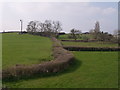
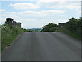

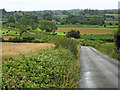

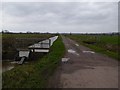
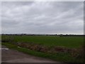
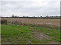
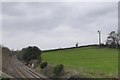
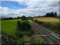
27 photos from this area
Area Information
Key information about the TA3 5AP including its size, population, and administrative classification.
- Area Type
- Postcode
- Area Size
- 3.4 km²
- Population
- 1234
- Population Density
- 61 people/km²
House Prices in TA3 5AP
31
Properties
£328,796
Average Sold Price
£64,000
Lowest Price
£500,000
Highest Price
Showing 31 properties
| Address | Type | Beds | Baths | Last Sale Price | Last Sale Date | |
|---|---|---|---|---|---|---|
| Lyng Court, Main Road, West Lyng, Taunton, TA3 5AP | Retail | 3 | 2 | £500,000 | Mar 2025 | |
| Bethlyne, Main Road, West Lyng, Taunton, TA3 5AP | house | - | - | £410,000 | Mar 2025 | |
| Rosedale, New Road, West Lyng, Taunton, TA3 5AP | house | - | - | £432,500 | May 2020 | |
| Summerleigh, Main Road, West Lyng, Taunton, TA3 5AP | Bungalow | 2 | 1 | £310,000 | Oct 2019 | |
| Gable Cottage, Main Road, West Lyng, Taunton, TA3 5AP | Semi-detached | 4 | 2 | £385,000 | May 2019 | |
| Elis Cottage, Main Road, West Lyng, Taunton, TA3 5AP | house | - | - | £232,500 | Aug 2016 | |
| Overlands, Main Road, West Lyng, Taunton, TA3 5AP | house | 4 | 3 | £450,000 | Apr 2015 | |
| Glebe Farm, Main Road, West Lyng, Taunton, TA3 5AP | Detached | - | - | £450,000 | Dec 2005 | |
| Ladymead, Main Road, West Lyng, Taunton, TA3 5AP | Semi-detached | - | - | £275,000 | Oct 2004 | |
| Moonrakers, Main Road, West Lyng, Taunton, TA3 5AP | Semi-detached | - | - | £196,550 | Dec 2002 |
Page 1 of 4
Energy Efficiency in TA3 5AP
Amenities
Schools
| Rank | School | Type | Entry gender | Ages |
|---|
Explore more schools in this area
Go to Schools tabDemographics
Household Size
Two person
most common
Accommodation Type
Houses
most common
Tenure
84
majority
Ethnic Group
White
most common
Religion
N/A
most common
Household Composition
N/A
most common
Age
47
median
Adults (30-64 years)
most common
Household Deprivation
N/A
with no deprivation
NS-SEC
34
in Lower managerial occupations
Explore more demographic insights in this area
Go to Demographics tabPlanning
Planning Constraints
- Flood RiskPremium
- Ramsar Wetland SitesPremium
- Area of Outstanding Natural BeautyPremium
- Protected Nature ReservePremium
- Protected WoodlandPremium