Area Overview for TA24 8RN
Photos of TA24 8RN
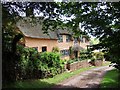
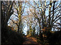
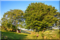

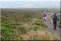
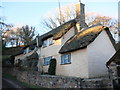
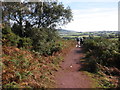
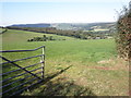


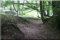
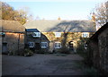
14 photos from this area
Area Information
Key information about the TA24 8RN including its size, population, and administrative classification.
- Area Type
- Postcode
- Area Size
- 1.2 km²
- Population
- 1991
- Population Density
- 33 people/km²
House Prices in TA24 8RN
12
Properties
£463,571
Average Sold Price
£220,000
Lowest Price
£740,000
Highest Price
Showing 12 properties
| Address | Type | Beds | Baths | Last Sale Price | Last Sale Date | |
|---|---|---|---|---|---|---|
| Winnocks Mead, Brockwell Lane, Wootton Courtenay, Minehead, TA24 8RN | house | 5 | - | £740,000 | Jun 2021 | |
| Tall Trees, Brockwell Lane, Wootton Courtenay, Minehead, TA24 8RN | Bungalow | 3 | - | £510,000 | Jun 2020 | |
| Butts Green, Brockwell Lane, Wootton Courtenay, Minehead, TA24 8RN | house | - | - | £385,000 | Jun 2018 | |
| Butts Orchard, Brockwell Lane, Wootton Courtenay, Minehead, TA24 8RN | Semi-detached | 2 | - | £260,000 | Nov 2014 | |
| Robin How, Brockwell Lane, Wootton Courtenay, Minehead, TA24 8RN | Equestrian | 3 | - | £570,000 | Oct 2003 | |
| Higher Brockwell, Brockwell Lane, Wootton Courtenay, Minehead, TA24 8RN | Land | 4 | - | £560,000 | May 2002 | |
| Meadowside, Brockwell Lane, Wootton Courtenay, Minehead, TA24 8RN | Bungalow | - | - | £220,000 | Dec 1999 | |
| Annexe, Rodings, Brockwell Lane, Wootton Courtenay, Minehead, TA24 8RN | Bungalow | 3 | 2 | - | - | |
| Glebe House, Brockwell Lane, Wootton Courtenay, Minehead, TA24 8RN | house | - | - | - | - | |
| Brockwell Barn, Brockwell Lane, Wootton Courtenay, Minehead, TA24 8RN | Bungalow | - | - | - | - |
Page 1 of 2
Energy Efficiency in TA24 8RN
Amenities
Schools
| Rank | School | Type | Entry gender | Ages |
|---|
Explore more schools in this area
Go to Schools tabDemographics
Household Size
Two person
most common
Accommodation Type
Houses
most common
Tenure
69
majority
Ethnic Group
White
most common
Religion
N/A
most common
Household Composition
N/A
most common
Age
47
median
Adults (30-64 years)
most common
Household Deprivation
N/A
with no deprivation
NS-SEC
30
in Lower managerial occupations
Explore more demographic insights in this area
Go to Demographics tabPlanning
Planning Constraints
- Flood RiskPremium
- Ramsar Wetland SitesPremium
- Area of Outstanding Natural BeautyPremium
- Protected Nature ReservePremium
- Protected WoodlandPremium