Area Overview for TA24 5UP
Photos of TA24 5UP

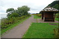
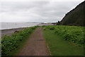
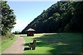
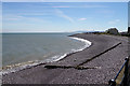
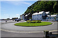
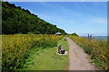
84 photos from this area
Area Information
Key information about the TA24 5UP including its size, population, and administrative classification.
- Area Type
- Postcode
- Area Size
- 1.6 hectares
- Population
- 1908
- Population Density
- 1054 people/km²
House Prices in TA24 5UP
9
Properties
£152,244
Average Sold Price
£80,000
Lowest Price
£190,000
Highest Price
Showing 9 properties
| Address | Type | Beds | Baths | Last Sale Price | Last Sale Date | |
|---|---|---|---|---|---|---|
| 8, Culvercliffe Court, Quay West, Minehead, TA24 5UP | Flat | - | - | £190,000 | Jun 2021 | |
| 2, CULVERCLIFFE COURT, QUAY WEST, Minehead, TA24 5UP | Flat | - | - | £162,500 | Nov 2018 | |
| 6, CULVERCLIFFE COURT, QUAY WEST, Minehead, TA24 5UP | Flat | 2 | 1 | £166,500 | Aug 2018 | |
| 5, Culvercliffe Court, Quay West, Minehead, TA24 5UP | Flat | - | - | £169,000 | Mar 2014 | |
| 1, Culvercliffe Court, Quay West, Minehead, TA24 5UP | Flat | - | - | £160,000 | May 2012 | |
| 4, CULVERCLIFFE COURT, QUAY WEST, Minehead, TA24 5UP | Flat | - | - | £160,000 | Aug 2009 | |
| 7, Culvercliffe Court, Quay West, Minehead, TA24 5UP | Flat | - | - | £129,950 | Aug 2004 | |
| 3, Culvercliffe Court, Quay West, Minehead, TA24 5UP | Flat | - | - | £80,000 | Jun 2001 | |
| Units 2 And 3, Quay West, Minehead, TA24 5UP | shop | - | - | - | - |
Energy Efficiency in TA24 5UP
Amenities
Schools
| Rank | School | Type | Entry gender | Ages |
|---|
Explore more schools in this area
Go to Schools tabDemographics
Household Size
One person
most common
Accommodation Type
Houses
most common
Tenure
68
majority
Ethnic Group
White
most common
Religion
N/A
most common
Household Composition
N/A
most common
Age
47
median
Elderly (65+ years)
most common
Household Deprivation
N/A
with no deprivation
NS-SEC
30
in Lower managerial occupations
Explore more demographic insights in this area
Go to Demographics tabPlanning
Planning Constraints
- Flood RiskPremium
- Ramsar Wetland SitesPremium
- Area of Outstanding Natural BeautyPremium
- Protected Nature ReservePremium
- Protected WoodlandPremium