Area Overview for TA21 9AD
Photos of TA21 9AD

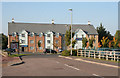
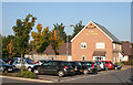


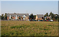

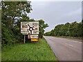
28 photos from this area
Area Information
Key information about the TA21 9AD including its size, population, and administrative classification.
- Area Type
- Postcode
- Area Size
- 13.9 hectares
- Population
- 2000
- Population Density
- 3105 people/km²
House Prices in TA21 9AD
34
Properties
£552,000
Average Sold Price
£552,000
Lowest Price
£552,000
Highest Price
Showing 34 properties
| Address | Type | Beds | Baths | Last Sale Price | Last Sale Date | |
|---|---|---|---|---|---|---|
| Cofee Shop With Drive Through, Plot 9.3, Westpark, Chelston, Wellington, TA21 9AD | undefined | - | - | £552,000 | Aug 2022 | |
| Unit 3G, Westpark, Chelston, Wellington, TA21 9AD | warehouse | - | - | - | - | |
| Data Coms Direct Ltd, Unit 3A, Westpark, Chelston, Wellington, TA21 9AD | office_workshop | - | - | - | - | |
| Office Reality Ltd, Unit 4D And J, Westpark, Chelston, Wellington, TA21 9AD | Office | - | - | - | - | |
| Data Coms Direct Ltd, Unit 3J, Westpark, Chelston, Wellington, TA21 9AD | office_workshop | - | - | - | - | |
| Marstons Plc, The Skylark, Westpark, Chelston, Wellington, TA21 9AD | restaurant_cafe | - | - | - | - | |
| The Flat, The Skylark, Westpark, Chelston, Wellington, TA21 9AD | Flat | - | - | - | - | |
| Summerfield Developments Sw Ltd, Unit 1P, Westpark, Chelston, Wellington, TA21 9AD | office_workshop | - | - | - | - | |
| Costa, Costa Drive Thru, Westpark, Chelston, Wellington, TA21 9AD | restaurant_cafe | - | - | - | - | |
| Units 11 And 12, Block B, Westpark, Chelston, Wellington, TA21 9AD | Office | - | - | - | - |
Page 1 of 4
Energy Efficiency in TA21 9AD
Amenities
Schools
| Rank | School | Type | Entry gender | Ages |
|---|
Explore more schools in this area
Go to Schools tabDemographics
Household Size
Family (3-5 people)
most common
Accommodation Type
Houses
most common
Tenure
67
majority
Ethnic Group
White
most common
Religion
N/A
most common
Household Composition
N/A
most common
Age
47
median
Adults (30-64 years)
most common
Household Deprivation
N/A
with no deprivation
NS-SEC
34
in Lower managerial occupations
Explore more demographic insights in this area
Go to Demographics tabPlanning
Planning Constraints
- Flood RiskPremium
- Ramsar Wetland SitesPremium
- Area of Outstanding Natural BeautyPremium
- Protected Nature ReservePremium
- Protected WoodlandPremium