Area Overview for TA21 8EA
Photos of TA21 8EA
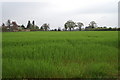
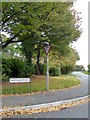
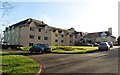
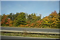

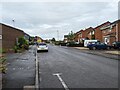
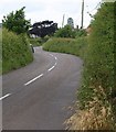
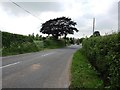
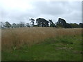

13 photos from this area
Area Information
Key information about the TA21 8EA including its size, population, and administrative classification.
- Area Type
- Postcode
- Area Size
- 1.2 hectares
- Population
- 1918
- Population Density
- 1693 people/km²
House Prices in TA21 8EA
9
Properties
£366,750
Average Sold Price
£250,000
Lowest Price
£600,000
Highest Price
Showing 9 properties
| Address | Type | Beds | Baths | Last Sale Price | Last Sale Date | |
|---|---|---|---|---|---|---|
| Greenend, Pyles Thorne, Wellington, TA21 8EA | Bungalow | - | - | £600,000 | Aug 2024 | |
| Shiralee, Pyles Thorne, Wellington, TA21 8EA | Semi-detached | 3 | 1 | £265,500 | Jun 2021 | |
| Chimes, Pyles Thorne, Wellington, TA21 8EA | Detached | - | - | £465,000 | Dec 2019 | |
| Derwen, Pyles Thorne, Wellington, TA21 8EA | Bungalow | - | - | £358,000 | Sep 2017 | |
| Harpers Lodge, Pyles Thorne, Wellington, TA21 8EA | Detached | - | - | £262,000 | Nov 2014 | |
| 2, Oakleigh, Pyles Thorne, Wellington, TA21 8EA | Semi-detached | - | - | £250,000 | Jun 2005 | |
| Oakleigh Cottage, Pyles Thorne, Wellington, TA21 8EA | Semi-detached | - | - | - | - | |
| 1, Oakleigh, Pyles Thorne, Wellington, TA21 8EA | Semi-detached | - | - | - | - | |
| Oakside, Pyles Thorne, Wellington, TA21 8EA | Detached | - | - | - | - |
Energy Efficiency in TA21 8EA
Amenities
Schools
| Rank | School | Type | Entry gender | Ages |
|---|
Explore more schools in this area
Go to Schools tabDemographics
Household Size
Two person
most common
Accommodation Type
Houses
most common
Tenure
80
majority
Ethnic Group
White
most common
Religion
N/A
most common
Household Composition
N/A
most common
Age
47
median
Adults (30-64 years)
most common
Household Deprivation
N/A
with no deprivation
NS-SEC
36
in Lower managerial occupations
Explore more demographic insights in this area
Go to Demographics tabPlanning
Planning Constraints
- Flood RiskPremium
- Ramsar Wetland SitesPremium
- Area of Outstanding Natural BeautyPremium
- Protected Nature ReservePremium
- Protected WoodlandPremium