Area Overview for TA21 0DY
Photos of TA21 0DY
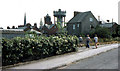
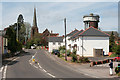
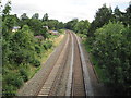
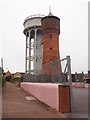
100 photos from this area
Area Information
Key information about the TA21 0DY including its size, population, and administrative classification.
- Area Type
- Postcode
- Area Size
- 2.6 hectares
- Population
- 1391
- Population Density
- 822 people/km²
House Prices in TA21 0DY
17
Properties
£209,967
Average Sold Price
£15,000
Lowest Price
£365,000
Highest Price
Showing 17 properties
| Address | Type | Beds | Baths | Last Sale Price | Last Sale Date | |
|---|---|---|---|---|---|---|
| Pippins, 2 Westford Close, Wellington, TA21 0DY | Bungalow | 3 | 1 | £260,000 | Jan 2025 | |
| 17 Westford Close, Wellington, TA21 0DY | Bungalow | - | - | £365,000 | Nov 2023 | |
| 13 Westford Close, Wellington, TA21 0DY | house | - | - | £15,000 | Oct 2023 | |
| 7 Westford Close, Wellington, TA21 0DY | Bungalow | 3 | 1 | £275,000 | Oct 2023 | |
| 1 Westford Close, Wellington, TA21 0DY | Bungalow | - | - | £270,000 | Dec 2022 | |
| 4 Westford Close, Wellington, TA21 0DY | Bungalow | 3 | 2 | £175,000 | Mar 2020 | |
| 14 Westford Close, Wellington, TA21 0DY | Bungalow | 3 | 3 | £235,000 | Nov 2019 | |
| 15 Westford Close, Wellington, TA21 0DY | Bungalow | 3 | - | £225,000 | Dec 2016 | |
| 16 Westford Close, Wellington, TA21 0DY | Bungalow | 3 | 1 | £245,000 | Jun 2014 | |
| 3 Westford Close, Wellington, TA21 0DY | Retail | 3 | 2 | £155,000 | May 2009 |
Page 1 of 2
Energy Efficiency in TA21 0DY
Amenities
Schools
| Rank | School | Type | Entry gender | Ages |
|---|
Explore more schools in this area
Go to Schools tabDemographics
Household Size
Two person
most common
Accommodation Type
Houses
most common
Tenure
60
majority
Ethnic Group
White
most common
Religion
N/A
most common
Household Composition
N/A
most common
Age
47
median
Adults (30-64 years)
most common
Household Deprivation
N/A
with no deprivation
NS-SEC
25
in Lower managerial occupations
Explore more demographic insights in this area
Go to Demographics tabPlanning
Planning Constraints
- Flood RiskPremium
- Ramsar Wetland SitesPremium
- Area of Outstanding Natural BeautyPremium
- Protected Nature ReservePremium
- Protected WoodlandPremium