Area Overview for TA21 0BB
Photos of TA21 0BB

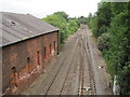
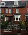


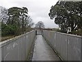
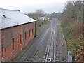
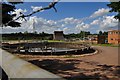


42 photos from this area
Area Information
Key information about the TA21 0BB including its size, population, and administrative classification.
- Area Type
- Postcode
- Area Size
- 9816 m²
- Population
- 1614
- Population Density
- 1229 people/km²
House Prices in TA21 0BB
40
Properties
£87,932
Average Sold Price
£19,000
Lowest Price
£197,950
Highest Price
Showing 40 properties
| Address | Type | Beds | Baths | Last Sale Price | Last Sale Date | |
|---|---|---|---|---|---|---|
| 82 Wardleworth Way, Tonedale, Wellington, TA21 0BB | Terraced | 2 | 1 | £185,000 | Dec 2025 | |
| 66 Wardleworth Way, Tonedale, Wellington, TA21 0BB | Terraced | 2 | 1 | £160,000 | Jun 2025 | |
| 12 Wardleworth Way, Tonedale, Wellington, TA21 0BB | Flat | 1 | 1 | £99,000 | Apr 2024 | |
| 88 Wardleworth Way, Tonedale, Wellington, TA21 0BB | house | - | - | £135,000 | Aug 2023 | |
| 80 Wardleworth Way, Tonedale, Wellington, TA21 0BB | house | 2 | 1 | £197,950 | Aug 2023 | |
| 14 Wardleworth Way, Tonedale, Wellington, TA21 0BB | Flat | - | - | £93,000 | Jul 2023 | |
| 28 Wardleworth Way, Tonedale, Wellington, TA21 0BB | Flat | - | - | £86,500 | Jan 2023 | |
| 22 Wardleworth Way, Tonedale, Wellington, TA21 0BB | Retail | 1 | 1 | £115,000 | Dec 2022 | |
| 74 Wardleworth Way, Tonedale, Wellington, TA21 0BB | Flat | - | - | £69,000 | Nov 2022 | |
| 52 Wardleworth Way, Tonedale, Wellington, TA21 0BB | Flat | 1 | 1 | £104,000 | Oct 2022 |
Page 1 of 4
Energy Efficiency in TA21 0BB
Amenities
Schools
| Rank | School | Type | Entry gender | Ages |
|---|
Explore more schools in this area
Go to Schools tabDemographics
Household Size
Two person
most common
Accommodation Type
Houses
most common
Tenure
69
majority
Ethnic Group
White
most common
Religion
N/A
most common
Household Composition
N/A
most common
Age
47
median
Adults (30-64 years)
most common
Household Deprivation
N/A
with no deprivation
NS-SEC
30
in Lower managerial occupations
Explore more demographic insights in this area
Go to Demographics tabPlanning
Planning Constraints
- Flood RiskPremium
- Ramsar Wetland SitesPremium
- Area of Outstanding Natural BeautyPremium
- Protected Nature ReservePremium
- Protected WoodlandPremium