Area Overview for TA20 2NX
Photos of TA20 2NX
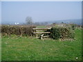
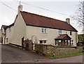
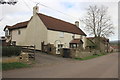
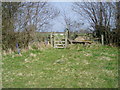
14 photos from this area
Area Information
Key information about the TA20 2NX including its size, population, and administrative classification.
- Area Type
- Postcode
- Area Size
- 1.4 km²
- Population
- 1444
- Population Density
- 100 people/km²
House Prices in TA20 2NX
10
Properties
£625,000
Average Sold Price
£425,000
Lowest Price
£825,000
Highest Price
Showing 10 properties
| Address | Type | Beds | Baths | Last Sale Price | Last Sale Date | |
|---|---|---|---|---|---|---|
| Home Farm, Chilson, South Chard, Chard, TA20 2NX | house | - | - | £825,000 | Nov 2020 | |
| Pond Close, Chilson, South Chard, Chard, TA20 2NX | house | - | - | £425,000 | Dec 2016 | |
| Chilson Cottage, Chilson, South Chard, Chard, TA20 2NX | Detached | 5 | - | - | - | |
| Lower Stockham Farm, Chilson, South Chard, Chard, TA20 2NX | Detached | - | - | - | - | |
| Lilac Cottage, Chilson, South Chard, Chard, TA20 2NX | Semi-detached | - | - | - | - | |
| Chilson Farm, Chilson, South Chard, Chard, TA20 2NX | Detached | - | - | - | - | |
| Western Power Distribution Land Os 6782, Chilson, South Chard, Chard, TA20 2NX | commercial | - | - | - | - | |
| Little Stocks, Chilson, South Chard, Chard, TA20 2NX | house | - | - | - | - | |
| Stable End, Home Farm, Chilson, South Chard, Chard, TA20 2NX | Semi-detached | 2 | - | - | - | |
| The Annexe, Pond Close, Chilson, South Chard, Chard, TA20 2NX | Flat | - | - | - | - |
Energy Efficiency in TA20 2NX
Amenities
Schools
| Rank | School | Type | Entry gender | Ages |
|---|
Explore more schools in this area
Go to Schools tabDemographics
Household Size
Two person
most common
Accommodation Type
Houses
most common
Tenure
88
majority
Ethnic Group
White
most common
Religion
N/A
most common
Household Composition
N/A
most common
Age
47
median
Adults (30-64 years)
most common
Household Deprivation
N/A
with no deprivation
NS-SEC
30
in Lower managerial occupations
Explore more demographic insights in this area
Go to Demographics tabPlanning
Planning Constraints
- Flood RiskPremium
- Ramsar Wetland SitesPremium
- Area of Outstanding Natural BeautyPremium
- Protected Nature ReservePremium
- Protected WoodlandPremium