Area Overview for TA2 8AY
Photos of TA2 8AY


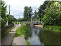
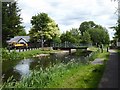
48 photos from this area
Area Information
Key information about the TA2 8AY including its size, population, and administrative classification.
- Area Type
- Postcode
- Area Size
- 2.3 hectares
- Population
- 2147
- Population Density
- 4023 people/km²
House Prices in TA2 8AY
46
Properties
£284,837
Average Sold Price
£105,000
Lowest Price
£542,500
Highest Price
Showing 46 properties
| Address | Type | Beds | Baths | Last Sale Price | Last Sale Date | |
|---|---|---|---|---|---|---|
| 31 Hardys Road, Bathpool, Taunton, TA2 8AY | Terraced | 2 | 1 | £200,000 | Jul 2025 | |
| 41 Hardys Road, Bathpool, Taunton, TA2 8AY | Semi-detached | 3 | 2 | £300,000 | Mar 2025 | |
| 62 Hardys Road, Bathpool, Taunton, TA2 8AY | Semi-detached | 4 | 2 | £365,000 | Nov 2024 | |
| 15 Hardys Road, Bathpool, Taunton, TA2 8AY | Detached | 5 | 3 | £542,500 | Nov 2024 | |
| 43 Hardys Road, Bathpool, Taunton, TA2 8AY | house | - | - | £295,000 | Feb 2024 | |
| 78 Hardys Road, Bathpool, Taunton, TA2 8AY | Detached | 4 | 3 | £105,000 | Aug 2023 | |
| 82 Hardys Road, Bathpool, Taunton, TA2 8AY | Terraced | 3 | - | £108,000 | Jun 2023 | |
| 35 Hardys Road, Bathpool, Taunton, TA2 8AY | Terraced | 2 | 1 | £215,000 | Jun 2022 | |
| 29 Hardys Road, Bathpool, Taunton, TA2 8AY | house | - | - | £372,500 | Feb 2019 | |
| 25 Hardys Road, Bathpool, Taunton, TA2 8AY | house | - | - | £357,005 | Sep 2018 |
Page 1 of 5
Energy Efficiency in TA2 8AY
Amenities
Schools
| Rank | School | Type | Entry gender | Ages |
|---|
Explore more schools in this area
Go to Schools tabDemographics
Household Size
Family (3-5 people)
most common
Accommodation Type
Houses
most common
Tenure
74
majority
Ethnic Group
White
most common
Religion
N/A
most common
Household Composition
N/A
most common
Age
47
median
Adults (30-64 years)
most common
Household Deprivation
N/A
with no deprivation
NS-SEC
43
in Lower managerial occupations
Explore more demographic insights in this area
Go to Demographics tabPlanning
Planning Constraints
- Flood RiskPremium
- Ramsar Wetland SitesPremium
- Area of Outstanding Natural BeautyPremium
- Protected Nature ReservePremium
- Protected WoodlandPremium