Area Overview for TA2 7SZ
Photos of TA2 7SZ
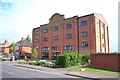
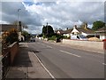
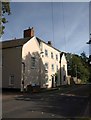
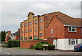
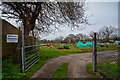
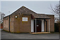
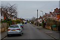
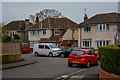
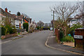
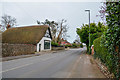
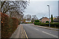
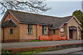
34 photos from this area
Area Information
Key information about the TA2 7SZ including its size, population, and administrative classification.
- Area Type
- Postcode
- Area Size
- 4.5 hectares
- Population
- 1427
- Population Density
- 5337 people/km²
House Prices in TA2 7SZ
55
Properties
£258,300
Average Sold Price
£85,950
Lowest Price
£575,000
Highest Price
Showing 55 properties
| Address | Type | Beds | Baths | Last Sale Price | Last Sale Date | |
|---|---|---|---|---|---|---|
| 16 Peile Drive, Taunton, TA2 7SZ | Detached | 4 | 2 | £500,000 | Dec 2025 | |
| 63 Peile Drive, Taunton, TA2 7SZ | Detached | 4 | 2 | £525,000 | May 2025 | |
| 61 Peile Drive, Taunton, TA2 7SZ | Detached | 4 | 2 | £575,000 | Mar 2025 | |
| 19 Peile Drive, Taunton, TA2 7SZ | Detached | 4 | 2 | £387,500 | Jun 2024 | |
| 24 Peile Drive, Taunton, TA2 7SZ | house | - | - | £405,000 | Jan 2024 | |
| 37 Peile Drive, Taunton, TA2 7SZ | Detached | 4 | 2 | £395,000 | Nov 2023 | |
| 25 Peile Drive, Taunton, TA2 7SZ | house | - | - | £520,000 | Aug 2023 | |
| 42 Peile Drive, Taunton, TA2 7SZ | Detached | 4 | 3 | £495,000 | Jun 2023 | |
| 30 Peile Drive, Taunton, TA2 7SZ | Retail | 3 | 1 | £350,000 | Dec 2022 | |
| 10 Peile Drive, Taunton, TA2 7SZ | house | - | - | £440,000 | Sep 2021 |
Page 1 of 6
Energy Efficiency in TA2 7SZ
Amenities
Schools
| Rank | School | Type | Entry gender | Ages |
|---|
Explore more schools in this area
Go to Schools tabDemographics
Household Size
Two person
most common
Accommodation Type
Houses
most common
Tenure
65
majority
Ethnic Group
White
most common
Religion
N/A
most common
Household Composition
N/A
most common
Age
47
median
Adults (30-64 years)
most common
Household Deprivation
N/A
with no deprivation
NS-SEC
37
in Lower managerial occupations
Explore more demographic insights in this area
Go to Demographics tabPlanning
Planning Constraints
- Flood RiskPremium
- Ramsar Wetland SitesPremium
- Area of Outstanding Natural BeautyPremium
- Protected Nature ReservePremium
- Protected WoodlandPremium