Area Overview for TA2 6UF
Photos of TA2 6UF


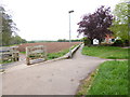
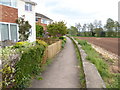
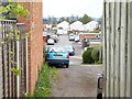
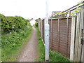

58 photos from this area
Area Information
Key information about the TA2 6UF including its size, population, and administrative classification.
- Area Type
- Postcode
- Area Size
- 1.6 hectares
- Population
- 1403
- Population Density
- 2181 people/km²
House Prices in TA2 6UF
50
Properties
£132,980
Average Sold Price
£49,000
Lowest Price
£319,950
Highest Price
Showing 50 properties
| Address | Type | Beds | Baths | Last Sale Price | Last Sale Date | |
|---|---|---|---|---|---|---|
| 20 Mallory Close, Staplegrove, Taunton, TA2 6UF | Semi-detached | 3 | 1 | £217,000 | Jul 2023 | |
| 42 Mallory Close, Staplegrove, Taunton, TA2 6UF | Semi-detached | 2 | - | £170,000 | Dec 2018 | |
| 4 Mallory Close, Staplegrove, Taunton, TA2 6UF | Detached | 7 | 7 | £319,950 | Jun 2018 | |
| 19 Mallory Close, Staplegrove, Taunton, TA2 6UF | Semi-detached | 4 | 1 | £204,000 | Jan 2017 | |
| 14 Mallory Close, Staplegrove, Taunton, TA2 6UF | Semi-detached | 1 | 1 | £115,000 | Nov 2016 | |
| 7 Mallory Close, Staplegrove, Taunton, TA2 6UF | Semi-detached | 4 | 1 | £185,000 | Nov 2014 | |
| 25 Mallory Close, Staplegrove, Taunton, TA2 6UF | Semi-detached | 4 | - | £195,000 | Jul 2014 | |
| 21 Mallory Close, Staplegrove, Taunton, TA2 6UF | house | - | - | £172,000 | Aug 2009 | |
| 31 Mallory Close, Staplegrove, Taunton, TA2 6UF | Semi-detached | - | - | £208,500 | Oct 2007 | |
| 40 Mallory Close, Staplegrove, Taunton, TA2 6UF | Semi-detached | 4 | 1 | £175,000 | Mar 2006 |
Page 1 of 5
Energy Efficiency in TA2 6UF
Amenities
Schools
| Rank | School | Type | Entry gender | Ages |
|---|
Explore more schools in this area
Go to Schools tabDemographics
Household Size
Two person
most common
Accommodation Type
Houses
most common
Tenure
63
majority
Ethnic Group
White
most common
Religion
N/A
most common
Household Composition
N/A
most common
Age
47
median
Adults (30-64 years)
most common
Household Deprivation
N/A
with no deprivation
NS-SEC
32
in Lower managerial occupations
Explore more demographic insights in this area
Go to Demographics tabPlanning
Planning Constraints
- Flood RiskPremium
- Ramsar Wetland SitesPremium
- Area of Outstanding Natural BeautyPremium
- Protected Nature ReservePremium
- Protected WoodlandPremium