Area Overview for TA2 6AL
Photos of TA2 6AL
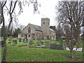


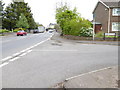
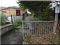


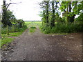


42 photos from this area
Area Information
Key information about the TA2 6AL including its size, population, and administrative classification.
- Area Type
- Postcode
- Area Size
- 6.3 hectares
- Population
- 1718
- Population Density
- 1498 people/km²
House Prices in TA2 6AL
34
Properties
£390,364
Average Sold Price
£102,000
Lowest Price
£675,000
Highest Price
Showing 34 properties
| Address | Type | Beds | Baths | Last Sale Price | Last Sale Date | |
|---|---|---|---|---|---|---|
| 283 Staplegrove Road, Staplegrove, Taunton, TA2 6AL | Detached | 5 | 2 | £675,000 | Mar 2025 | |
| 289 Staplegrove Road, Staplegrove, Taunton, TA2 6AL | Bungalow | 3 | 1 | £450,000 | Feb 2021 | |
| 220 Staplegrove Road, Staplegrove, Taunton, TA2 6AL | Bungalow | - | - | £500,000 | Oct 2020 | |
| 281 Staplegrove Road, Staplegrove, Taunton, TA2 6AL | house | - | - | £545,000 | Nov 2017 | |
| Heathfield House, 218B Staplegrove Road, Staplegrove, Taunton, TA2 6AL | house | - | - | £540,000 | Aug 2010 | |
| 230 Staplegrove Road, Staplegrove, Taunton, TA2 6AL | house | - | - | £270,000 | Jul 2008 | |
| 208 Staplegrove Road, Staplegrove, Taunton, TA2 6AL | Bungalow | 3 | - | £375,000 | Jul 2005 | |
| 222 Staplegrove Road, Staplegrove, Taunton, TA2 6AL | Terraced | - | - | £363,000 | Jun 2005 | |
| 210 Staplegrove Road, Staplegrove, Taunton, TA2 6AL | Bungalow | - | - | £305,000 | Oct 2003 | |
| 226 Staplegrove Road, Staplegrove, Taunton, TA2 6AL | Detached | - | - | £102,000 | Jun 1999 |
Page 1 of 4
Energy Efficiency in TA2 6AL
Amenities
Schools
| Rank | School | Type | Entry gender | Ages |
|---|
Explore more schools in this area
Go to Schools tabDemographics
Household Size
One person
most common
Accommodation Type
Houses
most common
Tenure
76
majority
Ethnic Group
White
most common
Religion
N/A
most common
Household Composition
N/A
most common
Age
47
median
Adults (30-64 years)
most common
Household Deprivation
N/A
with no deprivation
NS-SEC
36
in Lower managerial occupations
Explore more demographic insights in this area
Go to Demographics tabPlanning
Planning Constraints
- Flood RiskPremium
- Ramsar Wetland SitesPremium
- Area of Outstanding Natural BeautyPremium
- Protected Nature ReservePremium
- Protected WoodlandPremium