Area Overview for TA19 0BQ
Photos of TA19 0BQ
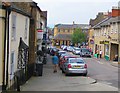
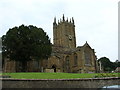
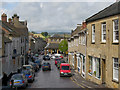
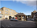


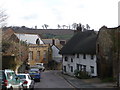
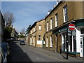
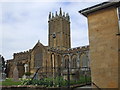
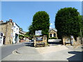

100 photos from this area
Area Information
Key information about the TA19 0BQ including its size, population, and administrative classification.
- Area Type
- Postcode
- Area Size
- 2.0 hectares
- Population
- 1945
- Population Density
- 218 people/km²
House Prices in TA19 0BQ
60
Properties
£226,781
Average Sold Price
£45,000
Lowest Price
£950,000
Highest Price
Showing 60 properties
| Address | Type | Beds | Baths | Last Sale Price | Last Sale Date | |
|---|---|---|---|---|---|---|
| 22 Ditton Street, Ilminster, TA19 0BQ | Terraced | - | - | £150,000 | Jan 2023 | |
| 23 Ditton Street, Ilminster, TA19 0BQ | house | - | - | £200,000 | Apr 2022 | |
| Lydons, Ditton Street, Ilminster, TA19 0BQ | Semi-detached | 2 | 1 | £157,500 | Mar 2022 | |
| Ditton Cottage, Ditton Street, Ilminster, TA19 0BQ | Detached | 4 | 2 | £343,500 | Dec 2021 | |
| Ditton Lea, Ditton Street, Ilminster, TA19 0BQ | Semi-detached | - | - | £950,000 | Dec 2021 | |
| Olcote House, 33 Ditton Street, Ilminster, TA19 0BQ | house | - | - | £607,000 | Oct 2018 | |
| 20 Ditton Street, Ilminster, TA19 0BQ | house | 3 | 1 | £175,000 | Jan 2018 | |
| 27 Ditton Street, Ilminster, TA19 0BQ | Terraced | 3 | 1 | £145,000 | Oct 2016 | |
| 26 Ditton Street, Ilminster, TA19 0BQ | house | 2 | - | £95,000 | Apr 2014 | |
| 18 Ditton Street, Ilminster, TA19 0BQ | Terraced | 2 | 1 | £80,000 | Apr 2008 |
Page 1 of 6
Energy Efficiency in TA19 0BQ
Amenities
Schools
| Rank | School | Type | Entry gender | Ages |
|---|
Explore more schools in this area
Go to Schools tabDemographics
Household Size
One person
most common
Accommodation Type
Houses
most common
Tenure
59
majority
Ethnic Group
White
most common
Religion
N/A
most common
Household Composition
N/A
most common
Age
47
median
Adults (30-64 years)
most common
Household Deprivation
N/A
with no deprivation
NS-SEC
32
in Lower managerial occupations
Explore more demographic insights in this area
Go to Demographics tabPlanning
Planning Constraints
- Flood RiskPremium
- Ramsar Wetland SitesPremium
- Area of Outstanding Natural BeautyPremium
- Protected Nature ReservePremium
- Protected WoodlandPremium