Area Overview for TA18 8HQ
Photos of TA18 8HQ

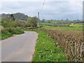


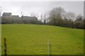
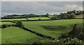


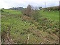
14 photos from this area
Area Information
Key information about the TA18 8HQ including its size, population, and administrative classification.
- Area Type
- Postcode
- Area Size
- 2.4 hectares
- Population
- 1671
- Population Density
- 1068 people/km²
House Prices in TA18 8HQ
43
Properties
£173,723
Average Sold Price
£24,375
Lowest Price
£360,000
Highest Price
Showing 43 properties
| Address | Type | Beds | Baths | Last Sale Price | Last Sale Date | |
|---|---|---|---|---|---|---|
| 30 Lang Road, Crewkerne, TA18 8HQ | house | - | - | £280,000 | Mar 2024 | |
| 9 Lang Road, Crewkerne, TA18 8HQ | Terraced | 1 | 1 | £142,000 | Jan 2022 | |
| 5 Lang Road, Crewkerne, TA18 8HQ | house | - | - | £145,000 | Dec 2021 | |
| 25 Lang Road, Crewkerne, TA18 8HQ | Terraced | 3 | - | £275,000 | Jun 2021 | |
| Fairwind, Lang Road, Crewkerne, TA18 8HQ | house | 3 | - | £360,000 | Mar 2021 | |
| Casa Mia, Lang Road, Crewkerne, TA18 8HQ | house | - | - | £250,000 | Jun 2019 | |
| Orchard House, Lang Road, Crewkerne, TA18 8HQ | house | - | - | £225,000 | May 2018 | |
| Court View, Lang Road, Crewkerne, TA18 8HQ | Detached | 3 | - | £312,000 | Jan 2018 | |
| 15 Lang Road, Crewkerne, TA18 8HQ | Cottage | 2 | 1 | £97,500 | Mar 2017 | |
| 11 Lang Road, Crewkerne, TA18 8HQ | Cottage | 2 | 1 | £135,000 | Oct 2016 |
Page 1 of 5
Energy Efficiency in TA18 8HQ
Amenities
Schools
| Rank | School | Type | Entry gender | Ages |
|---|
Explore more schools in this area
Go to Schools tabDemographics
Household Size
One person
most common
Accommodation Type
Houses
most common
Tenure
66
majority
Ethnic Group
White
most common
Religion
N/A
most common
Household Composition
N/A
most common
Age
47
median
Adults (30-64 years)
most common
Household Deprivation
N/A
with no deprivation
NS-SEC
33
in Lower managerial occupations
Explore more demographic insights in this area
Go to Demographics tabPlanning
Planning Constraints
- Flood RiskPremium
- Ramsar Wetland SitesPremium
- Area of Outstanding Natural BeautyPremium
- Protected Nature ReservePremium
- Protected WoodlandPremium