Area Overview for TA18 7SH
Photos of TA18 7SH
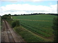
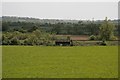

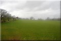
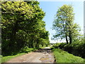

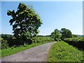
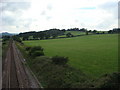
8 photos from this area
Area Information
Key information about the TA18 7SH including its size, population, and administrative classification.
- Area Type
- Postcode
- Area Size
- 2.3 km²
- Population
- 1297
- Population Density
- 89 people/km²
House Prices in TA18 7SH
22
Properties
£455,950
Average Sold Price
£52,000
Lowest Price
£1,685,000
Highest Price
Showing 22 properties
| Address | Type | Beds | Baths | Last Sale Price | Last Sale Date | |
|---|---|---|---|---|---|---|
| 3, New Buildings, Downclose Lane, North Perrott, Crewkerne, TA18 7SH | Terraced | 2 | 1 | £205,000 | Apr 2024 | |
| Downclose Stud, Downclose Lane, North Perrott, Crewkerne, TA18 7SH | house | - | - | £1,685,000 | Mar 2024 | |
| 6, New Buildings, Downclose Lane, North Perrott, Crewkerne, TA18 7SH | house | 2 | - | £280,000 | Aug 2022 | |
| 4, New Buildings, Downclose Lane, North Perrott, Crewkerne, TA18 7SH | Terraced | 2 | 1 | £190,000 | Dec 2017 | |
| 5, New Buildings, Downclose Lane, North Perrott, Crewkerne, TA18 7SH | house | - | - | £172,500 | Mar 2012 | |
| Bakery Cottage, Downclose Lane, North Perrott, Crewkerne, TA18 7SH | house | 3 | - | £165,000 | Jul 2011 | |
| 1 Downclose Lane, North Perrott, Crewkerne, TA18 7SH | Land | - | - | £172,000 | Oct 2009 | |
| Crondle Hill, Downclose Lane, North Perrott, Crewkerne, TA18 7SH | Detached | - | - | £1,500,000 | Mar 2007 | |
| The Old Bakery, Downclose Lane, North Perrott, Crewkerne, TA18 7SH | Terraced | - | - | £138,000 | Dec 1999 | |
| 7, New Buildings, Downclose Lane, North Perrott, Crewkerne, TA18 7SH | house | 2 | - | £52,000 | Sep 1998 |
Page 1 of 3
Energy Efficiency in TA18 7SH
Amenities
Schools
| Rank | School | Type | Entry gender | Ages |
|---|
Explore more schools in this area
Go to Schools tabDemographics
Household Size
Two person
most common
Accommodation Type
Houses
most common
Tenure
75
majority
Ethnic Group
White
most common
Religion
N/A
most common
Household Composition
N/A
most common
Age
47
median
Adults (30-64 years)
most common
Household Deprivation
N/A
with no deprivation
NS-SEC
38
in Lower managerial occupations
Explore more demographic insights in this area
Go to Demographics tabPlanning
Planning Constraints
- Flood RiskPremium
- Ramsar Wetland SitesPremium
- Area of Outstanding Natural BeautyPremium
- Protected Nature ReservePremium
- Protected WoodlandPremium