Area Overview for TA17 8SF
Photos of TA17 8SF
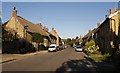
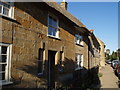
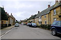
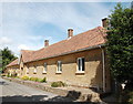
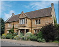
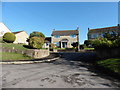
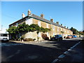
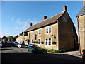
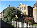
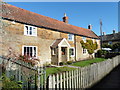
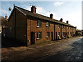
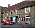
27 photos from this area
Area Information
Key information about the TA17 8SF including its size, population, and administrative classification.
- Area Type
- Postcode
- Area Size
- 1.6 hectares
- Population
- 1435
- Population Density
- 76 people/km²
House Prices in TA17 8SF
11
Properties
£246,629
Average Sold Price
£95,000
Lowest Price
£394,775
Highest Price
Showing 11 properties
| Address | Type | Beds | Baths | Last Sale Price | Last Sale Date | |
|---|---|---|---|---|---|---|
| Willow Cottage, Lopen Road, Hinton St George, TA17 8SF | Semi-detached | 2 | 1 | £270,000 | Jun 2014 | |
| 10 Lopen Road, Hinton St George, TA17 8SF | Terraced | 2 | - | £135,000 | Mar 2013 | |
| Hornbeams, Lopen Road, Hinton St George, TA17 8SF | Bungalow | - | - | £365,000 | Nov 2012 | |
| Russets, Lopen Road, Hinton St George, TA17 8SF | Detached | - | - | £394,775 | Jul 2006 | |
| Les Godets, Lopen Road, Hinton St George, TA17 8SF | Detached | - | - | £220,000 | Jun 2006 | |
| 11 Lopen Road, Hinton St George, TA17 8SF | Terraced | - | - | £95,000 | Jul 2001 | |
| Catmint Cottage, 15 Lopen Road, Hinton St George, TA17 8SF | Bungalow | 3 | 1 | - | - | |
| Samares, Lopen Road, Hinton St George, TA17 8SF | Detached | - | - | - | - | |
| Bakery Cottage, Lopen Road, Hinton St George, TA17 8SF | Detached | - | - | - | - | |
| Rivendell, 13 Lopen Road, Hinton St George, TA17 8SF | Terraced | - | - | - | - |
Page 1 of 2
Energy Efficiency in TA17 8SF
Amenities
Schools
| Rank | School | Type | Entry gender | Ages |
|---|
Explore more schools in this area
Go to Schools tabDemographics
Household Size
Two person
most common
Accommodation Type
Houses
most common
Tenure
79
majority
Ethnic Group
White
most common
Religion
N/A
most common
Household Composition
N/A
most common
Age
47
median
Adults (30-64 years)
most common
Household Deprivation
N/A
with no deprivation
NS-SEC
44
in Lower managerial occupations
Explore more demographic insights in this area
Go to Demographics tabPlanning
Planning Constraints
- Flood RiskPremium
- Ramsar Wetland SitesPremium
- Area of Outstanding Natural BeautyPremium
- Protected Nature ReservePremium
- Protected WoodlandPremium