Area Overview for TA14 6TF
Photos of TA14 6TF
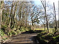
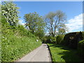
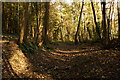
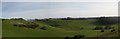
13 photos from this area
Area Information
Key information about the TA14 6TF including its size, population, and administrative classification.
- Area Type
- Postcode
- Area Size
- 1.7 km²
- Population
- 1278
- Population Density
- 233 people/km²
House Prices in TA14 6TF
8
Properties
£533,000
Average Sold Price
£437,500
Lowest Price
£628,500
Highest Price
Showing 8 properties
| Address | Type | Beds | Baths | Last Sale Price | Last Sale Date | |
|---|---|---|---|---|---|---|
| Park Mill Cottage, Little Norton, Norton Sub Hamdon, Stoke Sub Hamdon, TA14 6TF | house | 4 | - | £628,500 | Dec 2016 | |
| Tinkabee Cottage, Little Norton, Norton Sub Hamdon, Stoke Sub Hamdon, TA14 6TF | Cottage | 2 | - | £437,500 | Feb 2013 | |
| High Wood Farm, Little Norton, Norton Sub Hamdon, Stoke Sub Hamdon, TA14 6TF | Unknown | 2 | 1 | - | - | |
| Westbury Farm, Hockers Hill, Norton Sub Hamdon, Stoke Sub Hamdon, TA14 6TF | Detached | 3 | - | - | - | |
| Tinkers Bubble, Little Norton, Norton Sub Hamdon, Stoke Sub Hamdon, TA14 6TF | Unknown | - | - | - | - | |
| Stable Cottage, Bagnell Farm, Little Norton, Norton Sub Hamdon, Stoke Sub Hamdon, TA14 6TF | house | - | - | - | - | |
| Bagnell Farm, Little Norton, Norton Sub Hamdon, Stoke Sub Hamdon, TA14 6TF | house | - | - | - | - | |
| Bagnell Farm Cottage, Little Norton, Norton Sub Hamdon, Stoke Sub Hamdon, TA14 6TF | Cottage | 2 | 1 | - | - |
Energy Efficiency in TA14 6TF
Amenities
Schools
| Rank | School | Type | Entry gender | Ages |
|---|
Explore more schools in this area
Go to Schools tabDemographics
Household Size
Two person
most common
Accommodation Type
Houses
most common
Tenure
70
majority
Ethnic Group
White
most common
Religion
N/A
most common
Household Composition
N/A
most common
Age
47
median
Adults (30-64 years)
most common
Household Deprivation
N/A
with no deprivation
NS-SEC
35
in Lower managerial occupations
Explore more demographic insights in this area
Go to Demographics tabPlanning
Planning Constraints
- Flood RiskPremium
- Ramsar Wetland SitesPremium
- Area of Outstanding Natural BeautyPremium
- Protected Nature ReservePremium
- Protected WoodlandPremium