Area Overview for TA12 6HX
Photos of TA12 6HX
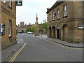


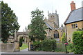
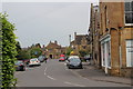
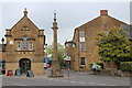

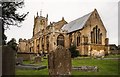
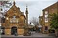
100 photos from this area
Area Information
Key information about the TA12 6HX including its size, population, and administrative classification.
- Area Type
- Postcode
- Area Size
- 2589 m²
- Population
- 1202
- Population Density
- 366 people/km²
House Prices in TA12 6HX
9
Properties
£124,122
Average Sold Price
£44,950
Lowest Price
£415,000
Highest Price
Showing 9 properties
| Address | Type | Beds | Baths | Last Sale Price | Last Sale Date | |
|---|---|---|---|---|---|---|
| 2 Bearley Bridge Road, Martock, TA12 6HX | Bungalow | 2 | 1 | £415,000 | Jun 2023 | |
| 10 Bearley Bridge Road, Martock, TA12 6HX | Terraced | 2 | 1 | £160,000 | Jan 2018 | |
| 12 Bearley Bridge Road, Martock, TA12 6HX | house | 2 | - | £145,000 | Dec 2011 | |
| 16 Bearley Bridge Road, Martock, TA12 6HX | Terraced | - | - | £69,000 | Oct 2001 | |
| 14 Bearley Bridge Road, Martock, TA12 6HX | Terraced | 2 | 1 | £68,500 | Nov 2000 | |
| 6 Bearley Bridge Road, Martock, TA12 6HX | house | - | - | £50,750 | Jul 1999 | |
| 4 Bearley Bridge Road, Martock, TA12 6HX | Detached | - | - | £114,950 | Jun 1999 | |
| 8 Bearley Bridge Road, Martock, TA12 6HX | house | 2 | - | £44,950 | Jun 1996 | |
| 18 Bearley Bridge Road, Martock, TA12 6HX | house | - | - | £48,950 | Oct 1995 |
Energy Efficiency in TA12 6HX
Amenities
Schools
| Rank | School | Type | Entry gender | Ages |
|---|
Explore more schools in this area
Go to Schools tabDemographics
Household Size
One person
most common
Accommodation Type
Houses
most common
Tenure
57
majority
Ethnic Group
White
most common
Religion
N/A
most common
Household Composition
N/A
most common
Age
47
median
Adults (30-64 years)
most common
Household Deprivation
N/A
with no deprivation
NS-SEC
24
in Lower managerial occupations
Explore more demographic insights in this area
Go to Demographics tabPlanning
Planning Constraints
- Flood RiskPremium
- Ramsar Wetland SitesPremium
- Area of Outstanding Natural BeautyPremium
- Protected Nature ReservePremium
- Protected WoodlandPremium