Area Overview for TA12 6EY
Photos of TA12 6EY
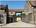
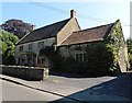
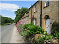
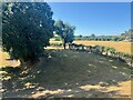
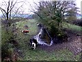
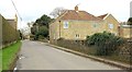
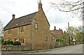
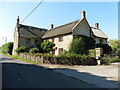
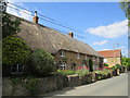
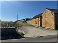
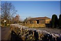
15 photos from this area
Area Information
Key information about the TA12 6EY including its size, population, and administrative classification.
- Area Type
- Postcode
- Area Size
- 2.7 hectares
- Population
- 1470
- Population Density
- 69 people/km²
House Prices in TA12 6EY
15
Properties
£202,400
Average Sold Price
£69,000
Lowest Price
£385,000
Highest Price
Showing 15 properties
| Address | Type | Beds | Baths | Last Sale Price | Last Sale Date | |
|---|---|---|---|---|---|---|
| The Sticks, Coat Road, Martock, TA12 6EY | Detached | 4 | 1 | £385,000 | Feb 2022 | |
| Colbrook, Newtown, Martock, TA12 6EY | Bungalow | 3 | - | £176,000 | Mar 2014 | |
| Elsper, Coat Road, Martock, TA12 6EY | Bungalow | - | - | £215,000 | Feb 2012 | |
| Apple Tree House, Coat Road, Martock, TA12 6EY | Detached | - | - | £167,000 | Jul 2002 | |
| Meadoway, Coat Road, Martock, TA12 6EY | Detached | - | - | £69,000 | Aug 1997 | |
| Stable View, Newtown, Martock, TA12 6EY | Detached | 4 | 2 | - | - | |
| Lyndale, Coat Road, Martock, TA12 6EY | Bungalow | 3 | 1 | - | - | |
| Brook House, Newtown, Martock, TA12 6EY | Detached | 3 | - | - | - | |
| Orchard Lee, Newtown, Martock, TA12 6EY | Semi-detached | 3 | - | - | - | |
| Charmyng, Coat Road, Martock, TA12 6EY | Detached | - | - | - | - |
Page 1 of 2
Energy Efficiency in TA12 6EY
Amenities
Schools
| Rank | School | Type | Entry gender | Ages |
|---|
Explore more schools in this area
Go to Schools tabDemographics
Household Size
Two person
most common
Accommodation Type
Houses
most common
Tenure
81
majority
Ethnic Group
White
most common
Religion
N/A
most common
Household Composition
N/A
most common
Age
47
median
Adults (30-64 years)
most common
Household Deprivation
N/A
with no deprivation
NS-SEC
39
in Lower managerial occupations
Explore more demographic insights in this area
Go to Demographics tabPlanning
Planning Constraints
- Flood RiskPremium
- Ramsar Wetland SitesPremium
- Area of Outstanding Natural BeautyPremium
- Protected Nature ReservePremium
- Protected WoodlandPremium