Area Overview for TA12 6AN
Photos of TA12 6AN
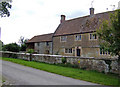
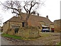
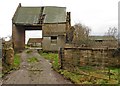


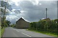
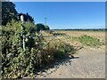


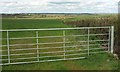
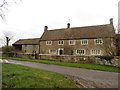
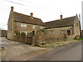
17 photos from this area
Area Information
Key information about the TA12 6AN including its size, population, and administrative classification.
- Area Type
- Postcode
- Area Size
- 87.1 hectares
- Population
- 1470
- Population Density
- 69 people/km²
House Prices in TA12 6AN
47
Properties
£371,954
Average Sold Price
£218,000
Lowest Price
£750,000
Highest Price
Showing 47 properties
| Address | Type | Beds | Baths | Last Sale Price | Last Sale Date | |
|---|---|---|---|---|---|---|
| Madingley Gardens, Stapleton Road, Martock, TA12 6AN | Bungalow | 4 | 2 | £750,000 | Feb 2025 | |
| Cross Farm, Stapleton Road, Martock, TA12 6AN | farmhouse | 4 | 2 | £452,000 | Jan 2021 | |
| Stapleton Croft, Stapleton Road, Martock, TA12 6AN | house | 3 | - | £360,000 | Mar 2020 | |
| Smithy Cottage, Stapleton Road, Martock, TA12 6AN | Semi-detached | 3 | 1 | £218,000 | Mar 2019 | |
| Oak Barn, Long Load Road, Martock, TA12 6AN | Semi-detached | 5 | 3 | £470,400 | Aug 2016 | |
| Hillview, Long Load Road, Martock, TA12 6AN | house | 3 | - | £265,000 | Feb 2013 | |
| Longlands Farm, Stapleton Road, Martock, TA12 6AN | house | - | - | £336,000 | Sep 2011 | |
| Parklands, Long Load Road, Martock, TA12 6AN | Bungalow | - | - | £470,000 | Dec 2010 | |
| Thatched Cottage, Long Load Road, Martock, TA12 6AN | house | 3 | - | £240,000 | Feb 2010 | |
| Long Barn, Long Load Road, Martock, TA12 6AN | Terraced | - | - | £365,000 | Mar 2007 |
Page 1 of 5
Energy Efficiency in TA12 6AN
Amenities
Schools
| Rank | School | Type | Entry gender | Ages |
|---|
Explore more schools in this area
Go to Schools tabDemographics
Household Size
Two person
most common
Accommodation Type
Houses
most common
Tenure
81
majority
Ethnic Group
White
most common
Religion
N/A
most common
Household Composition
N/A
most common
Age
47
median
Adults (30-64 years)
most common
Household Deprivation
N/A
with no deprivation
NS-SEC
39
in Lower managerial occupations
Explore more demographic insights in this area
Go to Demographics tabPlanning
Planning Constraints
- Flood RiskPremium
- Ramsar Wetland SitesPremium
- Area of Outstanding Natural BeautyPremium
- Protected Nature ReservePremium
- Protected WoodlandPremium