Area Overview for TA11 7DB
Photos of TA11 7DB
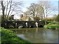

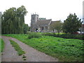
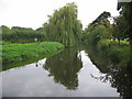
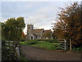
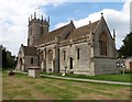

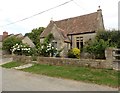
43 photos from this area
Area Information
Key information about the TA11 7DB including its size, population, and administrative classification.
- Area Type
- Postcode
- Area Size
- 12.0 hectares
- Population
- 2102
- Population Density
- 41 people/km²
House Prices in TA11 7DB
17
Properties
£541,383
Average Sold Price
£225,000
Lowest Price
£1,050,000
Highest Price
Showing 17 properties
| Address | Type | Beds | Baths | Last Sale Price | Last Sale Date | |
|---|---|---|---|---|---|---|
| Barberry, High Street, West Lydford, Somerton, TA11 7DB | house | - | - | £615,000 | Jan 2025 | |
| Kingham, High Street, West Lydford, Somerton, TA11 7DB | house | 5 | 3 | £1,050,000 | Jul 2024 | |
| Crooked Beams, High Street, West Lydford, Somerton, TA11 7DB | house | 3 | 2 | £499,950 | Dec 2022 | |
| The Old School House, High Street, West Lydford, Somerton, TA11 7DB | Detached | 3 | 3 | £745,000 | Dec 2021 | |
| Elskede, 44 High Street, West Lydford, Somerton, TA11 7DB | Semi-detached | 3 | 2 | £310,000 | Feb 2020 | |
| Shilling House, High Street, West Lydford, Somerton, TA11 7DB | house | - | - | £512,500 | Jul 2019 | |
| Glenn, High Street, West Lydford, Somerton, TA11 7DB | Bungalow | - | - | £325,000 | Aug 2017 | |
| High Street Farm, High Street, West Lydford, Somerton, TA11 7DB | Detached | 5 | 3 | £590,000 | May 2017 | |
| Brue Side, High Street, West Lydford, Somerton, TA11 7DB | Semi-detached | - | - | £225,000 | May 2005 | |
| Brue Cottage, High Street, West Lydford, Somerton, TA11 7DB | Semi-detached | 3 | 2 | - | - |
Page 1 of 2
Energy Efficiency in TA11 7DB
Amenities
Schools
| Rank | School | Type | Entry gender | Ages |
|---|
Explore more schools in this area
Go to Schools tabDemographics
Household Size
Two person
most common
Accommodation Type
Houses
most common
Tenure
77
majority
Ethnic Group
White
most common
Religion
N/A
most common
Household Composition
N/A
most common
Age
47
median
Adults (30-64 years)
most common
Household Deprivation
N/A
with no deprivation
NS-SEC
38
in Lower managerial occupations
Explore more demographic insights in this area
Go to Demographics tabPlanning
Planning Constraints
- Flood RiskPremium
- Ramsar Wetland SitesPremium
- Area of Outstanding Natural BeautyPremium
- Protected Nature ReservePremium
- Protected WoodlandPremium