Area Overview for TA11 6ER
Photos of TA11 6ER

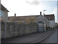
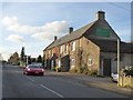
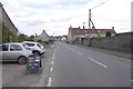
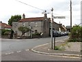
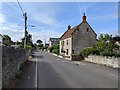
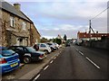
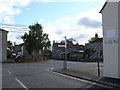
21 photos from this area
Area Information
Key information about the TA11 6ER including its size, population, and administrative classification.
- Area Type
- Postcode
- Area Size
- 35.5 hectares
- Population
- 1824
- Population Density
- 155 people/km²
House Prices in TA11 6ER
44
Properties
£302,543
Average Sold Price
£67,500
Lowest Price
£875,000
Highest Price
Showing 44 properties
| Address | Type | Beds | Baths | Last Sale Price | Last Sale Date | |
|---|---|---|---|---|---|---|
| Lakeview House, Church Street, Keinton Mandeville, Somerton, TA11 6ER | Detached | 5 | 2 | £875,000 | Jan 2025 | |
| 2 Church Street, Keinton Mandeville, Somerton, TA11 6ER | Detached | 4 | 2 | £302,000 | Jun 2022 | |
| The Brambles, Church Street, Keinton Mandeville, Somerton, TA11 6ER | Detached | 4 | 2 | £420,000 | Jun 2021 | |
| 1, Englefield Terrace, Church Street, Keinton Mandeville, Somerton, TA11 6ER | Terraced | 3 | 1 | £297,000 | Sep 2019 | |
| Juddering Halt, Church Street, Keinton Mandeville, Somerton, TA11 6ER | Detached | - | - | £67,500 | Jun 2018 | |
| Elm Cottage, Church Street, Keinton Mandeville, Somerton, TA11 6ER | house | - | - | £250,000 | Feb 2016 | |
| Yew House, Church Street, Keinton Mandeville, Somerton, TA11 6ER | house | - | - | £360,000 | Sep 2013 | |
| Birch Corner, Church Street, Keinton Mandeville, Somerton, TA11 6ER | Terraced | - | - | £285,000 | Aug 2008 | |
| Kingshill House, Church Street, Keinton Mandeville, Somerton, TA11 6ER | Detached | - | - | £430,000 | Apr 2008 | |
| Lynwood, Church Street, Keinton Mandeville, Somerton, TA11 6ER | Semi-detached | - | - | £215,000 | Jun 2005 |
Page 1 of 5
Energy Efficiency in TA11 6ER
Amenities
Schools
| Rank | School | Type | Entry gender | Ages |
|---|
Explore more schools in this area
Go to Schools tabDemographics
Household Size
Two person
most common
Accommodation Type
Houses
most common
Tenure
83
majority
Ethnic Group
White
most common
Religion
N/A
most common
Household Composition
N/A
most common
Age
47
median
Adults (30-64 years)
most common
Household Deprivation
N/A
with no deprivation
NS-SEC
41
in Lower managerial occupations
Explore more demographic insights in this area
Go to Demographics tabPlanning
Planning Constraints
- Flood RiskPremium
- Ramsar Wetland SitesPremium
- Area of Outstanding Natural BeautyPremium
- Protected Nature ReservePremium
- Protected WoodlandPremium