Area Overview for TA10 9PQ
Photos of TA10 9PQ
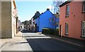
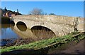
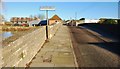
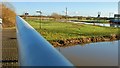
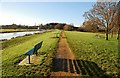
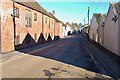
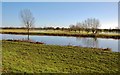
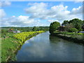

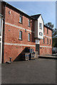
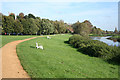
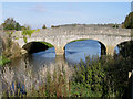
64 photos from this area
Area Information
Key information about the TA10 9PQ including its size, population, and administrative classification.
- Area Type
- Postcode
- Area Size
- 1.6 hectares
- Population
- 1587
- Population Density
- 1897 people/km²
House Prices in TA10 9PQ
28
Properties
£340,000
Average Sold Price
£260,000
Lowest Price
£420,000
Highest Price
Showing 28 properties
| Address | Type | Beds | Baths | Last Sale Price | Last Sale Date | |
|---|---|---|---|---|---|---|
| Homelea, Bow Street, Langport, TA10 9PQ | Terraced | 5 | 2 | £420,000 | Nov 2020 | |
| Arlington House, Bow Street, Langport, TA10 9PQ | Terraced | 4 | 1 | £260,000 | Dec 2017 | |
| Norman Cottage, Bow Street, Langport, TA10 9PQ | Detached | 3 | 2 | - | - | |
| The Shambles, Bow Street, Langport, TA10 9PQ | Terraced | 2 | - | - | - | |
| 50 Bow Street, Langport, TA10 9PQ | Terraced | 5 | 2 | - | - | |
| Blake House, Bow Street, Langport, TA10 9PQ | house | 7 | - | - | - | |
| Middle Bow, Bow Street, Langport, TA10 9PQ | house | - | - | - | - | |
| The Flat, Staceys Court, Bow Street, Langport, TA10 9PQ | Flat | - | - | - | - | |
| Flat 1B, Bow Street Emporium, Bow Street, Langport, TA10 9PQ | Flat | - | - | - | - | |
| 1, Bow Flats, Bow Street, Langport, TA10 9PQ | Flat | - | - | - | - |
Page 1 of 3
Energy Efficiency in TA10 9PQ
Amenities
Schools
| Rank | School | Type | Entry gender | Ages |
|---|
Explore more schools in this area
Go to Schools tabDemographics
Household Size
One person
most common
Accommodation Type
Houses
most common
Tenure
57
majority
Ethnic Group
White
most common
Religion
N/A
most common
Household Composition
N/A
most common
Age
47
median
Adults (30-64 years)
most common
Household Deprivation
N/A
with no deprivation
NS-SEC
29
in Lower managerial occupations
Explore more demographic insights in this area
Go to Demographics tabPlanning
Planning Constraints
- Flood RiskPremium
- Ramsar Wetland SitesPremium
- Area of Outstanding Natural BeautyPremium
- Protected Nature ReservePremium
- Protected WoodlandPremium