Area Overview for TA1 5AA
Photos of TA1 5AA

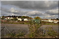
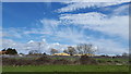

54 photos from this area
Area Information
Key information about the TA1 5AA including its size, population, and administrative classification.
- Area Type
- Postcode
- Area Size
- 49.1 hectares
- Population
- 2241
- Population Density
- 1680 people/km²
House Prices in TA1 5AA
17
Properties
£342,500
Average Sold Price
£185,000
Lowest Price
£500,000
Highest Price
Showing 17 properties
| Address | Type | Beds | Baths | Last Sale Price | Last Sale Date | |
|---|---|---|---|---|---|---|
| Loden House, Roughmoor Lane, Bishops Hull, Taunton, TA1 5AA | house | - | - | £500,000 | Feb 2025 | |
| Greenbrook Mill, Netherclay, Bishops Hull, Taunton, TA1 5AA | house | 4 | 2 | £185,000 | Dec 1999 | |
| Melton House, Roughmoor Lane, Bishops Hull, Taunton, TA1 5AA | Detached | 4 | 3 | - | - | |
| The Old Canteen, Roughmoor Farm, Roughmoor Lane, Bishops Hull, Taunton, TA1 5AA | Retail | - | - | - | - | |
| Roughmoor Farm, Roughmoor Lane, Bishops Hull, Taunton, TA1 5AA | Detached | 1 | 3 | - | - | |
| Westmead, Silk Mills Road, Bishops Hull, Taunton, TA1 5AA | Detached | 5 | - | - | - | |
| Mobile Home, Avery Plant Centre And Nursery, Silk Mills Road, Bishops Hull, Taunton, TA1 5AA | Mobile Home | - | - | - | - | |
| Brant House, Roughmoor Lane, Bishops Hull, Taunton, TA1 5AA | house | - | - | - | - | |
| Kingfishers Reach, Avery Plant Centre And Nursery, Silk Mills Road, Bishops Hull, Taunton, TA1 5AA | commercial | - | - | - | - | |
| Roughmoor Cottage, Netherclay, Bishops Hull, Taunton, TA1 5AA | house | - | - | - | - |
Page 1 of 2
Energy Efficiency in TA1 5AA
Amenities
Schools
| Rank | School | Type | Entry gender | Ages |
|---|
Explore more schools in this area
Go to Schools tabDemographics
Household Size
Family (3-5 people)
most common
Accommodation Type
Houses
most common
Tenure
60
majority
Ethnic Group
White
most common
Religion
N/A
most common
Household Composition
N/A
most common
Age
47
median
Adults (30-64 years)
most common
Household Deprivation
N/A
with no deprivation
NS-SEC
29
in Lower managerial occupations
Explore more demographic insights in this area
Go to Demographics tabPlanning
Planning Constraints
- Flood RiskPremium
- Ramsar Wetland SitesPremium
- Area of Outstanding Natural BeautyPremium
- Protected Nature ReservePremium
- Protected WoodlandPremium