Area Overview for TA1 4LG
Photos of TA1 4LG

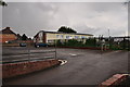
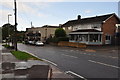
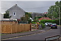
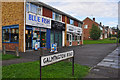
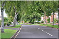
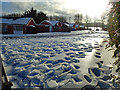
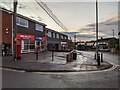
46 photos from this area
Area Information
Key information about the TA1 4LG including its size, population, and administrative classification.
- Area Type
- Postcode
- Area Size
- 9343 m²
- Population
- 1369
- Population Density
- 4573 people/km²
House Prices in TA1 4LG
28
Properties
£202,057
Average Sold Price
£65,000
Lowest Price
£330,000
Highest Price
Showing 28 properties
| Address | Type | Beds | Baths | Last Sale Price | Last Sale Date | |
|---|---|---|---|---|---|---|
| 53 Scafell Close, Taunton, TA1 4LG | Detached | 3 | 1 | £275,000 | Dec 2025 | |
| 27 Scafell Close, Taunton, TA1 4LG | Semi-detached | 3 | 1 | £315,000 | May 2024 | |
| 35 Scafell Close, Taunton, TA1 4LG | Semi-detached | 3 | 1 | £310,000 | Mar 2024 | |
| 49 Scafell Close, Taunton, TA1 4LG | Semi-detached | 3 | 1 | £330,000 | Jul 2023 | |
| 39 Scafell Close, Taunton, TA1 4LG | Semi-detached | 3 | 1 | £238,500 | Oct 2020 | |
| 31 Scafell Close, Taunton, TA1 4LG | house | - | - | £260,000 | Mar 2019 | |
| 47 Scafell Close, Taunton, TA1 4LG | Semi-detached | 3 | - | £242,000 | Aug 2017 | |
| 26 Scafell Close, Taunton, TA1 4LG | Semi-detached | 4 | - | £220,000 | Jul 2014 | |
| 37 Scafell Close, Taunton, TA1 4LG | Semi-detached | 4 | 2 | £244,000 | Jul 2012 | |
| 59 Scafell Close, Taunton, TA1 4LG | house | 4 | 2 | £225,000 | Sep 2009 |
Page 1 of 3
Energy Efficiency in TA1 4LG
Amenities
Schools
| Rank | School | Type | Entry gender | Ages |
|---|
Explore more schools in this area
Go to Schools tabDemographics
Household Size
Two person
most common
Accommodation Type
Houses
most common
Tenure
87
majority
Ethnic Group
White
most common
Religion
N/A
most common
Household Composition
N/A
most common
Age
47
median
Adults (30-64 years)
most common
Household Deprivation
N/A
with no deprivation
NS-SEC
40
in Lower managerial occupations
Explore more demographic insights in this area
Go to Demographics tabPlanning
Planning Constraints
- Flood RiskPremium
- Ramsar Wetland SitesPremium
- Area of Outstanding Natural BeautyPremium
- Protected Nature ReservePremium
- Protected WoodlandPremium