Area Overview for TA1 3JT
Photos of TA1 3JT
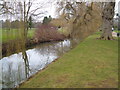
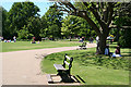
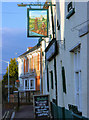
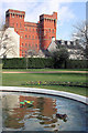
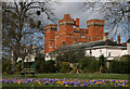
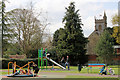
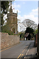
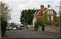
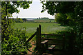
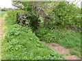
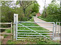
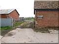
94 photos from this area
Area Information
Key information about the TA1 3JT including its size, population, and administrative classification.
- Area Type
- Postcode
- Area Size
- 9.1 hectares
- Population
- 2062
- Population Density
- 2460 people/km²
House Prices in TA1 3JT
21
Properties
£385,000
Average Sold Price
£380,000
Lowest Price
£390,000
Highest Price
Showing 21 properties
| Address | Type | Beds | Baths | Last Sale Price | Last Sale Date | |
|---|---|---|---|---|---|---|
| 2, Belle Vue Terrace, Fons George, Taunton, TA1 3JT | house | - | - | £380,000 | Jan 2022 | |
| Church View, Fons George, Taunton, TA1 3JT | Bungalow | 3 | - | £390,000 | Nov 2010 | |
| Wilton Cottage, Fons George, Taunton, TA1 3JT | Detached | 2 | 1 | - | - | |
| 3, Belle Vue Terrace, Fons George, Taunton, TA1 3JT | Terraced | 3 | 2 | - | - | |
| 1, Belle Vue Terrace, Fons George, Taunton, TA1 3JT | Terraced | 5 | 2 | - | - | |
| All Winds, Fons George, Taunton, TA1 3JT | Retail | 3 | 1 | - | - | |
| Fons George Villa, Fons George, Taunton, TA1 3JT | Semi-detached | 7 | 3 | - | - | |
| 4, Belle Vue Terrace, Fons George, Taunton, TA1 3JT | Terraced | 3 | 2 | - | - | |
| The Old Vicarage, Fons George, Taunton, TA1 3JT | house | - | - | - | - | |
| Wilton Vicarage, Fons George, Taunton, TA1 3JT | house | - | - | - | - |
Page 1 of 3
Energy Efficiency in TA1 3JT
Amenities
Schools
| Rank | School | Type | Entry gender | Ages |
|---|
Explore more schools in this area
Go to Schools tabDemographics
Household Size
One person
most common
Accommodation Type
Houses
most common
Tenure
54
majority
Ethnic Group
White
most common
Religion
N/A
most common
Household Composition
N/A
most common
Age
47
median
Adults (30-64 years)
most common
Household Deprivation
N/A
with no deprivation
NS-SEC
41
in Lower managerial occupations
Explore more demographic insights in this area
Go to Demographics tabPlanning
Planning Constraints
- Flood RiskPremium
- Ramsar Wetland SitesPremium
- Area of Outstanding Natural BeautyPremium
- Protected Nature ReservePremium
- Protected WoodlandPremium