Area Overview for TA1 3ED
Photos of TA1 3ED

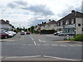


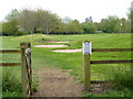

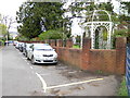
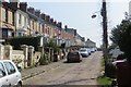


34 photos from this area
Area Information
Key information about the TA1 3ED including its size, population, and administrative classification.
- Area Type
- Postcode
- Area Size
- 6630 m²
- Population
- 2193
- Population Density
- 1580 people/km²
House Prices in TA1 3ED
19
Properties
£389,671
Average Sold Price
£226,200
Lowest Price
£575,000
Highest Price
Showing 19 properties
| Address | Type | Beds | Baths | Last Sale Price | Last Sale Date | |
|---|---|---|---|---|---|---|
| 131 South Road, Taunton, TA1 3ED | Terraced | 5 | 2 | £575,000 | Dec 2022 | |
| 127 South Road, Taunton, TA1 3ED | Semi-detached | 5 | 3 | £440,000 | Jun 2020 | |
| 135 South Road, Taunton, TA1 3ED | house | 5 | 3 | £313,500 | Dec 2019 | |
| 123 South Road, Taunton, TA1 3ED | Semi-detached | - | - | £480,000 | Oct 2017 | |
| 149 South Road, Taunton, TA1 3ED | Semi-detached | 4 | - | £393,000 | Jul 2017 | |
| 139 South Road, Taunton, TA1 3ED | house | 5 | - | £300,000 | Apr 2012 | |
| 133 South Road, Taunton, TA1 3ED | Terraced | - | - | £226,200 | May 2002 | |
| 147 South Road, Taunton, TA1 3ED | Detached | 3 | - | - | - | |
| 137 South Road, Taunton, TA1 3ED | Terraced | - | - | - | - | |
| Flat 3, 129 South Road, Taunton, TA1 3ED | commercial | - | - | - | - |
Page 1 of 2
Energy Efficiency in TA1 3ED
Amenities
Schools
| Rank | School | Type | Entry gender | Ages |
|---|
Explore more schools in this area
Go to Schools tabDemographics
Household Size
Two person
most common
Accommodation Type
Houses
most common
Tenure
81
majority
Ethnic Group
White
most common
Religion
N/A
most common
Household Composition
N/A
most common
Age
47
median
Adults (30-64 years)
most common
Household Deprivation
N/A
with no deprivation
NS-SEC
40
in Lower managerial occupations
Explore more demographic insights in this area
Go to Demographics tabPlanning
Planning Constraints
- Flood RiskPremium
- Ramsar Wetland SitesPremium
- Area of Outstanding Natural BeautyPremium
- Protected Nature ReservePremium
- Protected WoodlandPremium