Area Overview for TA1 3BT
Photos of TA1 3BT

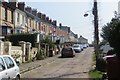


34 photos from this area
Area Information
Key information about the TA1 3BT including its size, population, and administrative classification.
- Area Type
- Postcode
- Area Size
- 9075 m²
- Population
- 2193
- Population Density
- 1580 people/km²
House Prices in TA1 3BT
12
Properties
£211,945
Average Sold Price
£77,553
Lowest Price
£345,000
Highest Price
Showing 12 properties
| Address | Type | Beds | Baths | Last Sale Price | Last Sale Date | |
|---|---|---|---|---|---|---|
| 25 Fremantle Road, Taunton, TA1 3BT | Detached | 2 | 1 | £275,000 | Jul 2025 | |
| 13 Fremantle Road, Taunton, TA1 3BT | Bungalow | 2 | - | £310,000 | Jul 2022 | |
| 23 Fremantle Road, Taunton, TA1 3BT | Semi-detached | 2 | 1 | £189,995 | Jul 2020 | |
| 19 Fremantle Road, Taunton, TA1 3BT | Bungalow | 2 | 1 | £279,950 | Jul 2018 | |
| 21 Fremantle Road, Taunton, TA1 3BT | Semi-detached | 2 | 1 | £220,000 | Mar 2015 | |
| 15 Fremantle Road, Taunton, TA1 3BT | Semi-detached | 2 | 1 | £194,950 | Jan 2014 | |
| 7 Fremantle Road, Taunton, TA1 3BT | house | 4 | - | £345,000 | Jun 2011 | |
| 11 Fremantle Road, Taunton, TA1 3BT | Semi-detached | - | - | £179,000 | Nov 2004 | |
| 17 Fremantle Road, Taunton, TA1 3BT | Semi-detached | - | - | £140,000 | Sep 2002 | |
| 9 Fremantle Road, Taunton, TA1 3BT | Detached | - | - | £119,950 | May 1997 |
Page 1 of 2
Energy Efficiency in TA1 3BT
Amenities
Schools
| Rank | School | Type | Entry gender | Ages |
|---|
Explore more schools in this area
Go to Schools tabDemographics
Household Size
Two person
most common
Accommodation Type
Houses
most common
Tenure
81
majority
Ethnic Group
White
most common
Religion
N/A
most common
Household Composition
N/A
most common
Age
47
median
Adults (30-64 years)
most common
Household Deprivation
N/A
with no deprivation
NS-SEC
40
in Lower managerial occupations
Explore more demographic insights in this area
Go to Demographics tabPlanning
Planning Constraints
- Flood RiskPremium
- Ramsar Wetland SitesPremium
- Area of Outstanding Natural BeautyPremium
- Protected Nature ReservePremium
- Protected WoodlandPremium