Area Overview for Stoke Bishop Ward
Photos of Stoke Bishop Ward


Area Information
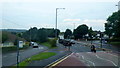
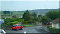
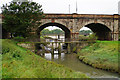
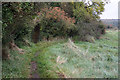
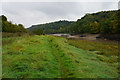
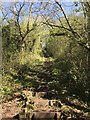
Stoke Bishop Ward occupies a substantial area of 5.7 km² in the north-western suburbs of Bristol, England. This district forms part of a well-established residential corridor that neighbours The Downs, the River Trym, and Westbury-on-Trym. With a population of 1,590 residents, the ward maintains a low population density of 277 people per square kilometre. This figure indicates that living in Stoke Bishop Ward involves spacious surroundings, distinct from the more compact urban centres nearby. The area functions as a historic suburb where large villas and private estates define the streetscape. Residents enjoy access to green spaces bounded by natural features such as the River Trym and the historic Stoke House. Daily life centres around a quiet, affluent neighbourhood that has evolved from farmland into a community of detached and semi-detached properties. The ward boundary extends towards Sneyd Park and Sea Mills, creating a seamless transition between different character zones within Bristol. Prospective residents find the location ideal for those seeking a tranquil environment close to significant landmarks like The Holmes and the parish church. The physical layout supports a lifestyle that prioritises privacy and access to nature while remaining integrated into the wider city structure. This specific configuration makes Stoke Bishop Ward a unique choice for individuals valuing established charm over modern density.
- Area Type
- District Borough Unitary Ward
- Area Size
- 5.7 km²
- Population
- 1590
- Population Density
- 277 people/km²
Demographics
The community within Stoke Bishop Ward demonstrates an older demographic profile compared to the national average. Data confirms that the median age in this ward stands at 70 years. This senior-heavy population suggests that the area attracts retirees or long-term residents who have established deep roots in the locality. Almost three-quarters of households hold their property with a home ownership rate of 75 per cent. This high proportion indicates that the local housing market is dominated by owner-occupiers rather than tenants. Such figures typically correlate with families requiring stability and long-term residents invested in their communities. The ward lacks specific data regarding household composition, predominant ethnic groups, religious affiliations, or accommodation types beyond the ownership split. Despite these gaps in granular detail, the overall age profile strongly influences the character of Stoke Bishop Ward. The prevalence of older residents often shapes local amenities and service focus around their needs. You will find a quiet neighbourhood where social interaction revolves around long-standing friendships and established community groups rather than transient hustle. For those considering living in Stoke Bishop Ward, understanding this age demographic is crucial for assessing the vibrancy and pace of everyday life. The lack of younger households may limit local nightlife or family-focused events, reinforcing a mature, peaceful atmosphere. Home buyers should weigh this demographic reality against their own lifestyle requirements. The data clearly paints a picture of a settled, elder-led community with minimal rental turnover.
Household Size
Accommodation Type
Tenure
Ethnic Group
Religion
Household Composition
Age
Household Deprivation
NS-SEC
Explore more demographic insights in this area
Go to Demographics tabPlanning
Planning Constraints
- Flood RiskPremium
- Ramsar Wetland SitesPremium
- Area of Outstanding Natural BeautyPremium
- Protected Nature ReservePremium
- Protected WoodlandPremium