Area Overview for Steeple with Tyneham
Photos of Steeple with Tyneham
Area Information
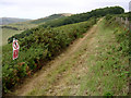
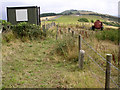
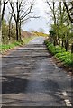
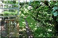
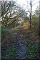
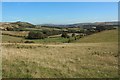
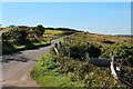
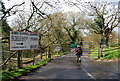
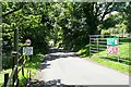
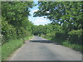
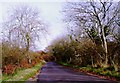
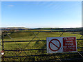
Steeple with Tyneham is a distinctive civil parish covering 25.8 km² in rural Dorset, located approximately 8 miles west of Swanage. You will find this area situated at the foot of Ridgeway Hill and the Purbeck Hills, surrounded by extensive heathland and downland near Lulworth and Corfe Castle. The parish comprises the surviving hamlet of Steeple and the ghost village of Tyneham, creating a living environment defined by historical depth and isolation rather than modern convenience. History traces back to the Domesday Book, where sites recorded as Stiple and Tigeham evolved into the current settlement. By 2014, the parishes formally merged, uniting a functioning community with evacuated land under one administrative banner. Daily life here revolves around a handful of landmarks, including the 12th-century St Michael and All Angels Church and the Grade I listed Steeple Manor. You will encounter sparse housing stock, as the majority of Tyneham remains frozen in its 1943 state following World War II requisition. The modern population concentrates around Creech Grange, a reconstructed site near the mansion built by Sir Oliver Lawrence. This setting attracts those seeking quiet seclusion amidst ancient landscapes. While you gain access to natural beauty and heritage sites like the Grange Arch folly, expect significant distance from mainstream urban centres. Life in Steeple with Tyneham requires adaptability and a preference for expansive skies over city vibrancy.
- Area Type
- Parish
- Area Size
- 25.8 km²
- Population
- Not available
- Population Density
- Not available
Demographics
The community profile in Steeple with Tyneham reflects a specific demographic reality driven by the area's rural nature and historical context. You will find a median resident age of 70, indicating a population skewed heavily towards later life. Although specific age range breakdowns are limited in the dataset, the high median age suggests a community where long-standing residents and retirees dominate. The total household composition and accommodation types are recorded but not detailed in granular fashion, implying a standard mix of rural dwellings. Crucially, 78% of homes here are owner-occupied, signalling strong stability and a lack of transient housing turnover. This high ownership rate contrasts with the minimal rental market present in the parish. You will not encounter a diverse mix of young professionals or families moving at breakneck pace; instead, the demographic landscape is static and low-density. The total population represents a very small number of individuals spread across Stonehenge landscapes and abandoned village plots. While data on ethnicity, religion, and primary age groups does not specify exact figures in this dataset, the overall picture emerges as a homogenous, older community. Living in Steeple with Tyneham means joining a neighbourhood where life pace slows significantly, and community ties are likely rooted in generations of local history rather than recent migration patterns. The 78% ownership figure remains the clearest indicator of who calls this remote parish home.
Household Size
Accommodation Type
Tenure
Ethnic Group
Religion
Household Composition
Age
Household Deprivation
NS-SEC
Explore more demographic insights in this area
Go to Demographics tabPlanning
Planning Constraints
- Flood RiskPremium
- Ramsar Wetland SitesPremium
- Area of Outstanding Natural BeautyPremium
- Protected Nature ReservePremium
- Protected WoodlandPremium
- Crime RiskPremium