Area Overview for St. Leonards and St. Ives
Photos of St. Leonards and St. Ives

Area Information
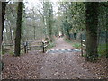
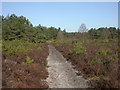
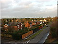
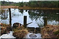
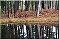
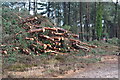
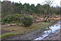
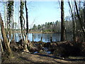
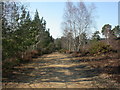
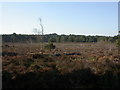
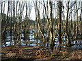
Living in St. Leonards and St. Ives means residing in a civil parish located in Dorset, South West England. This district covers an area of 24.9 square kilometres and holds a population of 1,686 residents. The area forms a distinctive neighbourhood that incorporates the historic hamlet of St. Leonards, named potentially pre-Domesday, and St. Ives, first recorded in 1781. You will find yourself in a setting that encompasses former heath and woodland areas, including the hamlet of Ashley Heath. This community was formally established as a civil parish on 1 April 1932, created from parts of Ringwood and Hurn parishes. The location sits in a region where the postcodes begin with BH24 and lie roughly at coordinates 50.839923, -1.843727. Daily life here is defined by a quiet rural character, though the area retains connections to its industrial past through historical railway lines. The parish existed originally in Hampshire before transferring to Dorset in 1974 under the Local Government Act 1972. You are buying into a location with deep roots, from the mid-17th century Avon Cottage to the mission church of All Saints built in 1912 on donated land. This mix of history and rural landscape defines the experience of any resident in this specific ward.
- Area Type
- District Borough Unitary Ward
- Area Size
- 24.9 km²
- Population
- 1686
- Population Density
- 68 people/km²
Demographics
The community within St. Leonards and St. Ives is characterised by an unusually high median age of 70 years. This demographic profile indicates a neighbourhood dominated by an older population compared to the national average. Your neighbours and the people you meet locally are likely to be in their seventies or older. Since the provided data does not specify age breaks beyond the total, the most common age range aligns with this high median figure. This suggests a village formed around retirement and established families who have remained in their homes for decades. Home ownership is exceptionally high in this area, with 90% of households owning their property outright or with a mortgage. This starkly contrasts with major rental markets found in city centres. The resident population of 1,686 people sustains this level of ownership, creating a stable community where people put down deep roots. There is no indication of significant transient populations or short-term lets. The local economy and social life revolve around these long-term residents. Understanding this demographic reality is vital when considering whether this is the right place for your future, as the social calendar and local services cater predominantly to an older, settled demographic.
Household Size
Accommodation Type
Tenure
Ethnic Group
Religion
Household Composition
Age
Household Deprivation
NS-SEC
Explore more demographic insights in this area
Go to Demographics tabPlanning
Planning Constraints
- Flood RiskLocked
- Ramsar Wetland SitesLocked
- Area of Outstanding Natural BeautyLocked
- Protected Nature ReserveLocked
- Protected WoodlandLocked
- Crime RiskLocked