Area Overview for SP9 7PG
Photos of SP9 7PG
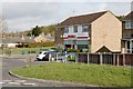
5 photos from this area
Area Information
Key information about the SP9 7PG including its size, population, and administrative classification.
- Area Type
- Postcode
- Area Size
- 10.6 hectares
- Population
- 2174
- Population Density
- 408 people/km²
House Prices in SP9 7PG
13
Properties
£125,650
Average Sold Price
£52,250
Lowest Price
£235,000
Highest Price
Showing 13 properties
| Address | Type | Beds | Baths | Last Sale Price | Last Sale Date | |
|---|---|---|---|---|---|---|
| 10 Ash Close, Tidworth, SP9 7PG | Terraced | 3 | 1 | £235,000 | Aug 2023 | |
| 9 Ash Close, Tidworth, SP9 7PG | house | - | - | £155,000 | Apr 2020 | |
| 1 Ash Close, Tidworth, SP9 7PG | Semi-detached | - | - | £144,000 | May 2014 | |
| 4 Ash Close, Tidworth, SP9 7PG | house | - | - | £160,000 | Jun 2007 | |
| 5 Ash Close, Tidworth, SP9 7PG | Semi-detached | - | - | £134,950 | Jan 2006 | |
| 13 Ash Close, Tidworth, SP9 7PG | house | - | - | £70,000 | Jul 2000 | |
| 3 Ash Close, Tidworth, SP9 7PG | Terraced | 4 | 2 | £54,000 | Dec 1997 | |
| 8 Ash Close, Tidworth, SP9 7PG | Semi-detached | - | - | £52,250 | Dec 1997 | |
| 6 Ash Close, Tidworth, SP9 7PG | Terraced | - | - | - | - | |
| 2 Ash Close, Tidworth, SP9 7PG | Terraced | - | - | - | - |
Page 1 of 2
Energy Efficiency in SP9 7PG
Amenities
Schools
| Rank | School | Type | Entry gender | Ages |
|---|
Explore more schools in this area
Go to Schools tabDemographics
Household Size
Family (3-5 people)
most common
Accommodation Type
Houses
most common
Tenure
37
majority
Ethnic Group
White
most common
Religion
N/A
most common
Household Composition
N/A
most common
Age
22
median
Young Adults (15-29 years)
most common
Household Deprivation
N/A
with no deprivation
NS-SEC
37
in Lower managerial occupations
Explore more demographic insights in this area
Go to Demographics tabPlanning
Planning Constraints
- Flood RiskPremium
- Ramsar Wetland SitesPremium
- Area of Outstanding Natural BeautyPremium
- Protected Nature ReservePremium
- Protected WoodlandPremium