Area Overview for SP9 7NS
Photos of SP9 7NS
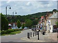
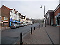
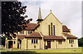
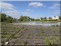

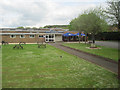
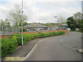
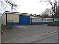
47 photos from this area
Area Information
Key information about the SP9 7NS including its size, population, and administrative classification.
- Area Type
- Postcode
- Area Size
- 3293 m²
- Population
- 2174
- Population Density
- 408 people/km²
House Prices in SP9 7NS
8
Properties
£175,714
Average Sold Price
£56,000
Lowest Price
£280,000
Highest Price
Showing 8 properties
| Address | Type | Beds | Baths | Last Sale Price | Last Sale Date | |
|---|---|---|---|---|---|---|
| 5, Railway Cottages, Station Road, Tidworth, SP9 7NS | house | 2 | 1 | £235,000 | Jan 2022 | |
| 3, Railway Cottages, Station Road, Tidworth, SP9 7NS | house | 3 | 1 | £175,000 | Mar 2020 | |
| 8, Railway Cottages, Station Road, Tidworth, SP9 7NS | Semi-detached | 3 | 2 | £280,000 | Apr 2019 | |
| 7, Railway Cottages, Station Road, Tidworth, SP9 7NS | house | 3 | - | £220,000 | Jul 2012 | |
| 1, Railway Cottages, Station Road, Tidworth, SP9 7NS | Semi-detached | 3 | - | £117,000 | Oct 2011 | |
| 2, Railway Cottages, Station Road, Tidworth, SP9 7NS | Semi-detached | 3 | 1 | £147,000 | Mar 2004 | |
| 6, Railway Cottages, Station Road, Tidworth, SP9 7NS | Semi-detached | - | - | £56,000 | Mar 1997 | |
| 4, Railway Cottages, Station Road, Tidworth, SP9 7NS | house | - | - | - | - |
Energy Efficiency in SP9 7NS
Amenities
Schools
| Rank | School | Type | Entry gender | Ages |
|---|
Explore more schools in this area
Go to Schools tabDemographics
Household Size
Family (3-5 people)
most common
Accommodation Type
Houses
most common
Tenure
37
majority
Ethnic Group
White
most common
Religion
N/A
most common
Household Composition
N/A
most common
Age
22
median
Young Adults (15-29 years)
most common
Household Deprivation
N/A
with no deprivation
NS-SEC
37
in Lower managerial occupations
Explore more demographic insights in this area
Go to Demographics tabPlanning
Planning Constraints
- Flood RiskPremium
- Ramsar Wetland SitesPremium
- Area of Outstanding Natural BeautyPremium
- Protected Nature ReservePremium
- Protected WoodlandPremium