Area Overview for SP8 5QG
Photos of SP8 5QG
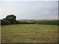
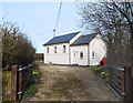
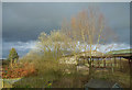
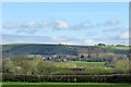
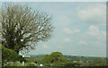
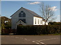
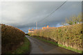
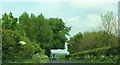

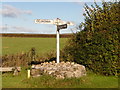
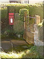
11 photos from this area
Area Information
Key information about the SP8 5QG including its size, population, and administrative classification.
- Area Type
- Postcode
- Area Size
- 1.1 km²
- Population
- 2265
- Population Density
- 154 people/km²
House Prices in SP8 5QG
13
Properties
£405,000
Average Sold Price
£170,000
Lowest Price
£640,000
Highest Price
Showing 13 properties
| Address | Type | Beds | Baths | Last Sale Price | Last Sale Date | |
|---|---|---|---|---|---|---|
| The Retreat, Mapperton Hill, Milton On Stour, SP8 5QG | Detached | 3 | 2 | £640,000 | Feb 2025 | |
| Highfield, Mapperton Hill, Milton On Stour, SP8 5QG | house | 6 | - | £170,000 | Sep 2000 | |
| Mapperton Hill Farm, Mapperton Hill, Milton On Stour, SP8 5QG | Detached | 4 | 1 | - | - | |
| 2, Rope Cottage, Mapperton Hill, Milton On Stour, SP8 5QG | Detached | - | - | - | - | |
| 1, Rope Cottage, Mapperton Hill, Milton On Stour, SP8 5QG | Detached | 2 | - | - | - | |
| The Old Dairy, Forge Grange Farm, Mapperton Hill, Milton On Stour, SP8 5QG | Detached | - | - | - | - | |
| Caravan At, Forge Grange Farm, Mapperton Hill, Milton On Stour, SP8 5QG | Mobile Home | - | - | - | - | |
| Annexe, Wessex Cottage, Mapperton Hill, Milton On Stour, SP8 5QG | Semi-detached | - | - | - | - | |
| Annexe, Highfield, Mapperton Hill, Milton On Stour, SP8 5QG | Semi-detached | - | - | - | - | |
| Forge Grange Farm, Mapperton Hill, Milton On Stour, SP8 5QG | Farm | - | - | - | - |
Page 1 of 2
Energy Efficiency in SP8 5QG
Amenities
Schools
| Rank | School | Type | Entry gender | Ages |
|---|
Explore more schools in this area
Go to Schools tabDemographics
Household Size
Two person
most common
Accommodation Type
Houses
most common
Tenure
74
majority
Ethnic Group
White
most common
Religion
N/A
most common
Household Composition
N/A
most common
Age
47
median
Adults (30-64 years)
most common
Household Deprivation
N/A
with no deprivation
NS-SEC
30
in Lower managerial occupations
Explore more demographic insights in this area
Go to Demographics tabPlanning
Planning Constraints
- Flood RiskPremium
- Ramsar Wetland SitesPremium
- Area of Outstanding Natural BeautyPremium
- Protected Nature ReservePremium
- Protected WoodlandPremium