Area Overview for SP8 5ND
Photos of SP8 5ND
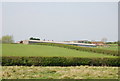
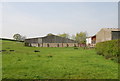
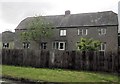
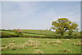
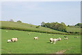
6 photos from this area
Area Information
Key information about the SP8 5ND including its size, population, and administrative classification.
- Area Type
- Postcode
- Area Size
- 90.9 hectares
- Population
- 1852
- Population Density
- 51 people/km²
House Prices in SP8 5ND
13
Properties
£194,625
Average Sold Price
£74,500
Lowest Price
£395,000
Highest Price
Showing 13 properties
| Address | Type | Beds | Baths | Last Sale Price | Last Sale Date | |
|---|---|---|---|---|---|---|
| Candleford, Fern Hill, East Stour, SP8 5ND | Detached | 4 | 1 | £395,000 | Jul 2016 | |
| Blackvenn Bungalow, Fern Hill, East Stour, SP8 5ND | Bungalow | - | - | £166,000 | Jun 2012 | |
| Poppys Patch, Fern Hill, East Stour, SP8 5ND | Detached | - | - | £143,000 | Oct 1999 | |
| Homelands, Fern Hill, East Stour, SP8 5ND | Detached | 5 | - | £74,500 | Nov 1995 | |
| Grosvenor House, Fern Hill, East Stour, SP8 5ND | house | 5 | - | - | - | |
| The Glen, Fern Hill, East Stour, SP8 5ND | Cottage | 5 | - | - | - | |
| Pennymoor Pit Farmhouse, Fern Hill, East Stour, SP8 5ND | Detached | - | - | - | - | |
| Lymebridge Cottage, Fern Hill, East Stour, SP8 5ND | Semi-detached | - | - | - | - | |
| Stour Vale House, Fern Hill, East Stour, SP8 5ND | Detached | - | - | - | - | |
| Firtree Cottage, Fern Hill, East Stour, SP8 5ND | Detached | - | - | - | - |
Page 1 of 2
Energy Efficiency in SP8 5ND
Amenities
Schools
| Rank | School | Type | Entry gender | Ages |
|---|
Explore more schools in this area
Go to Schools tabDemographics
Household Size
Two person
most common
Accommodation Type
Houses
most common
Tenure
82
majority
Ethnic Group
White
most common
Religion
N/A
most common
Household Composition
N/A
most common
Age
47
median
Adults (30-64 years)
most common
Household Deprivation
N/A
with no deprivation
NS-SEC
37
in Lower managerial occupations
Explore more demographic insights in this area
Go to Demographics tabPlanning
Planning Constraints
- Flood RiskPremium
- Ramsar Wetland SitesPremium
- Area of Outstanding Natural BeautyPremium
- Protected Nature ReservePremium
- Protected WoodlandPremium