Area Overview for SP8 5DH
Photos of SP8 5DH
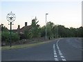
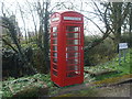
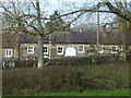
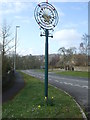
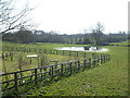
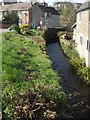
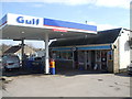
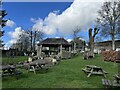
36 photos from this area
Area Information
Key information about the SP8 5DH including its size, population, and administrative classification.
- Area Type
- Postcode
- Area Size
- 3.3 hectares
- Population
- 1996
- Population Density
- 63 people/km²
House Prices in SP8 5DH
20
Properties
£342,363
Average Sold Price
£114,950
Lowest Price
£525,000
Highest Price
Showing 20 properties
| Address | Type | Beds | Baths | Last Sale Price | Last Sale Date | |
|---|---|---|---|---|---|---|
| 16 Mill Rise, Bourton, SP8 5DH | Detached | 4 | 2 | £525,000 | Jan 2025 | |
| 7 Mill Rise, Bourton, SP8 5DH | Detached | 4 | 2 | £475,000 | Jun 2024 | |
| 6 Mill Rise, Bourton, SP8 5DH | Detached | 4 | - | £438,000 | Jan 2021 | |
| 5 Mill Rise, Bourton, SP8 5DH | Detached | 4 | - | £340,000 | Sep 2019 | |
| 11 Mill Rise, Bourton, SP8 5DH | Detached | 4 | 2 | £380,000 | Aug 2018 | |
| 20 Mill Rise, Bourton, SP8 5DH | Detached | 4 | 2 | £360,000 | May 2017 | |
| 18 Mill Rise, Bourton, SP8 5DH | Detached | 4 | 2 | £340,000 | Nov 2015 | |
| Paihia, 10 Mill Rise, Bourton, SP8 5DH | Detached | 4 | 2 | £325,000 | Nov 2015 | |
| 12 Mill Rise, Bourton, SP8 5DH | Detached | 4 | - | £325,000 | Sep 2015 | |
| 4 Mill Rise, Bourton, SP8 5DH | Detached | 4 | - | £350,000 | Aug 2015 |
Page 1 of 2
Energy Efficiency in SP8 5DH
Amenities
Schools
| Rank | School | Type | Entry gender | Ages |
|---|
Explore more schools in this area
Go to Schools tabDemographics
Household Size
Two person
most common
Accommodation Type
Houses
most common
Tenure
80
majority
Ethnic Group
White
most common
Religion
N/A
most common
Household Composition
N/A
most common
Age
47
median
Adults (30-64 years)
most common
Household Deprivation
N/A
with no deprivation
NS-SEC
38
in Lower managerial occupations
Explore more demographic insights in this area
Go to Demographics tabPlanning
Planning Constraints
- Flood RiskPremium
- Ramsar Wetland SitesPremium
- Area of Outstanding Natural BeautyPremium
- Protected Nature ReservePremium
- Protected WoodlandPremium