Area Overview for SP8 4TJ
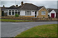
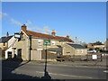
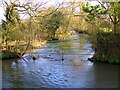
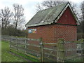
Photos of SP8 4TJ
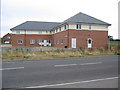
![Gillingham houses [25] in SP8 4TJ](https://images.propbar.co.uk/images/geograph/60/85/6085850_120.jpg)
![Gillingham houses [26] in SP8 4TJ](https://images.propbar.co.uk/images/geograph/60/85/6085853_120.jpg)
30 photos from this area
Area Information
Key information about the SP8 4TJ including its size, population, and administrative classification.
- Area Type
- Postcode
- Area Size
- 3.4 hectares
- Population
- 2265
- Population Density
- 154 people/km²
House Prices in SP8 4TJ
50
Properties
£207,540
Average Sold Price
£35,000
Lowest Price
£525,000
Highest Price
Showing 50 properties
| Address | Type | Beds | Baths | Last Sale Price | Last Sale Date | |
|---|---|---|---|---|---|---|
| 39 Cherryfields, Gillingham, SP8 4TJ | Bungalow | 3 | 2 | £455,000 | Jun 2025 | |
| 51 Cherryfields, Gillingham, SP8 4TJ | Detached | 4 | 2 | £425,000 | Jun 2025 | |
| 52 Cherryfields, Gillingham, SP8 4TJ | Detached | 4 | 2 | £387,500 | May 2025 | |
| 30 Cherryfields, Gillingham, SP8 4TJ | Detached | 3 | 1 | £244,000 | May 2025 | |
| 37 Cherryfields, Gillingham, SP8 4TJ | Detached | 4 | 2 | £392,000 | Dec 2024 | |
| 35 Cherryfields, Gillingham, SP8 4TJ | Detached | 4 | 3 | £372,500 | Dec 2024 | |
| 11 Cherryfields, Gillingham, SP8 4TJ | Semi-detached | 3 | 1 | £252,000 | Oct 2024 | |
| 20 Cherryfields, Gillingham, SP8 4TJ | house | - | - | £335,000 | Nov 2021 | |
| 48 Cherryfields, Gillingham, SP8 4TJ | Detached | 3 | 2 | £525,000 | Oct 2021 | |
| 7 Cherryfields, Gillingham, SP8 4TJ | Semi-detached | 3 | 1 | £220,000 | Apr 2021 |
Page 1 of 5
Energy Efficiency in SP8 4TJ
Amenities
Schools
| Rank | School | Type | Entry gender | Ages |
|---|
Explore more schools in this area
Go to Schools tabDemographics
Household Size
Two person
most common
Accommodation Type
Houses
most common
Tenure
74
majority
Ethnic Group
White
most common
Religion
N/A
most common
Household Composition
N/A
most common
Age
47
median
Adults (30-64 years)
most common
Household Deprivation
N/A
with no deprivation
NS-SEC
30
in Lower managerial occupations
Explore more demographic insights in this area
Go to Demographics tabPlanning
Planning Constraints
- Flood RiskPremium
- Ramsar Wetland SitesPremium
- Area of Outstanding Natural BeautyPremium
- Protected Nature ReservePremium
- Protected WoodlandPremium