Area Overview for SP8 4JU
Photos of SP8 4JU
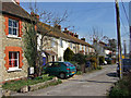
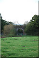
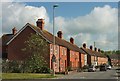
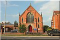

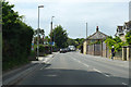
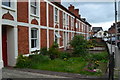
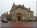
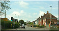
76 photos from this area
Area Information
Key information about the SP8 4JU including its size, population, and administrative classification.
- Area Type
- Postcode
- Area Size
- 2283 m²
- Population
- 2412
- Population Density
- 1613 people/km²
House Prices in SP8 4JU
10
Properties
£171,813
Average Sold Price
£120,000
Lowest Price
£242,500
Highest Price
Showing 10 properties
| Address | Type | Beds | Baths | Last Sale Price | Last Sale Date | |
|---|---|---|---|---|---|---|
| 10, Lawrence Cottages, Lawrence Walk, Gillingham, SP8 4JU | Terraced | 2 | 1 | £242,500 | Sep 2023 | |
| 1, Lawrence Cottages, Lawrence Walk, Gillingham, SP8 4JU | Terraced | 2 | 1 | £201,000 | Nov 2020 | |
| 2, Lawrence Cottages, Lawrence Walk, Gillingham, SP8 4JU | Terraced | 3 | 1 | £146,000 | Dec 2017 | |
| 6, Lawrence Cottages, Lawrence Walk, Gillingham, SP8 4JU | Terraced | 2 | - | £190,000 | Apr 2017 | |
| 4, Lawrence Cottages, Lawrence Walk, Gillingham, SP8 4JU | Cottage | 3 | 1 | £165,000 | Jun 2016 | |
| 5, Lawrence Cottages, Lawrence Walk, Gillingham, SP8 4JU | Terraced | 3 | - | £160,000 | May 2013 | |
| 3, Lawrence Cottages, Lawrence Walk, Gillingham, SP8 4JU | Terraced | - | - | £150,000 | Jun 2006 | |
| 7, Lawrence Cottages, Lawrence Walk, Gillingham, SP8 4JU | Terraced | 3 | - | £120,000 | Jul 2003 | |
| 9, Lawrence Cottages, Lawrence Walk, Gillingham, SP8 4JU | Terraced | - | - | - | - | |
| 8, Lawrence Cottages, Lawrence Walk, Gillingham, SP8 4JU | Terraced | - | - | - | - |
Energy Efficiency in SP8 4JU
Amenities
Schools
| Rank | School | Type | Entry gender | Ages |
|---|
Explore more schools in this area
Go to Schools tabDemographics
Household Size
One person
most common
Accommodation Type
Houses
most common
Tenure
54
majority
Ethnic Group
White
most common
Religion
N/A
most common
Household Composition
N/A
most common
Age
47
median
Adults (30-64 years)
most common
Household Deprivation
N/A
with no deprivation
NS-SEC
26
in Lower managerial occupations
Explore more demographic insights in this area
Go to Demographics tabPlanning
Planning Constraints
- Flood RiskPremium
- Ramsar Wetland SitesPremium
- Area of Outstanding Natural BeautyPremium
- Protected Nature ReservePremium
- Protected WoodlandPremium