Area Overview for SP8 4GY
Photos of SP8 4GY
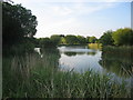
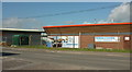
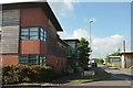
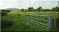
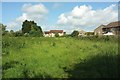
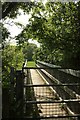
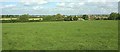
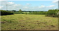
37 photos from this area
Area Information
Key information about the SP8 4GY including its size, population, and administrative classification.
- Area Type
- Postcode
- Area Size
- 8264 m²
- Population
- 1706
- Population Density
- 569 people/km²
House Prices in SP8 4GY
32
Properties
£180,498
Average Sold Price
£55,000
Lowest Price
£340,000
Highest Price
Showing 32 properties
| Address | Type | Beds | Baths | Last Sale Price | Last Sale Date | |
|---|---|---|---|---|---|---|
| 41 Jay Walk, Gillingham, SP8 4GY | Semi-detached | 3 | 1 | £127,500 | Nov 2025 | |
| 37 Jay Walk, Gillingham, SP8 4GY | Semi-detached | 3 | 2 | £260,000 | Jul 2025 | |
| 65 Jay Walk, Gillingham, SP8 4GY | Semi-detached | 1 | 1 | £180,000 | Nov 2024 | |
| 59 Jay Walk, Gillingham, SP8 4GY | Terraced | 2 | 1 | £200,000 | Aug 2024 | |
| 33 Jay Walk, Gillingham, SP8 4GY | Detached | 3 | 2 | £310,000 | Feb 2023 | |
| 7 Jay Walk, Gillingham, SP8 4GY | Semi-detached | 4 | 2 | £315,000 | Feb 2023 | |
| 5 Jay Walk, Gillingham, SP8 4GY | Semi-detached | 4 | 1 | £340,000 | Feb 2023 | |
| 53 Jay Walk, Gillingham, SP8 4GY | Semi-detached | 1 | 1 | £87,500 | Jan 2023 | |
| 47 Jay Walk, Gillingham, SP8 4GY | Terraced | 2 | 1 | £95,000 | Mar 2022 | |
| 43 Jay Walk, Gillingham, SP8 4GY | Terraced | 2 | - | £100,000 | Oct 2021 |
Page 1 of 4
Energy Efficiency in SP8 4GY
Amenities
Schools
| Rank | School | Type | Entry gender | Ages |
|---|
Explore more schools in this area
Go to Schools tabDemographics
Household Size
Family (3-5 people)
most common
Accommodation Type
Houses
most common
Tenure
72
majority
Ethnic Group
White
most common
Religion
N/A
most common
Household Composition
N/A
most common
Age
47
median
Adults (30-64 years)
most common
Household Deprivation
N/A
with no deprivation
NS-SEC
29
in Lower managerial occupations
Explore more demographic insights in this area
Go to Demographics tabPlanning
Planning Constraints
- Flood RiskPremium
- Ramsar Wetland SitesPremium
- Area of Outstanding Natural BeautyPremium
- Protected Nature ReservePremium
- Protected WoodlandPremium