Area Overview for SP7 8TJ
Photos of SP7 8TJ
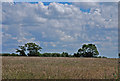
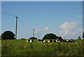
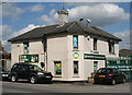
8 photos from this area
Area Information
Key information about the SP7 8TJ including its size, population, and administrative classification.
- Area Type
- Postcode
- Area Size
- 4.1 hectares
- Population
- 1819
- Population Density
- 2711 people/km²
House Prices in SP7 8TJ
60
Properties
£362,702
Average Sold Price
£289,950
Lowest Price
£500,000
Highest Price
Showing 60 properties
| Address | Type | Beds | Baths | Last Sale Price | Last Sale Date | |
|---|---|---|---|---|---|---|
| 44 Vale View, Shaftesbury, SP7 8TJ | Detached | 3 | 2 | £324,000 | Oct 2025 | |
| 46 Vale View, Shaftesbury, SP7 8TJ | Semi-detached | 3 | 1 | £333,000 | Jul 2025 | |
| 108 Vale View, Shaftesbury, SP7 8TJ | Semi-detached | 3 | 2 | £325,000 | Nov 2023 | |
| 28 Vale View, Shaftesbury, SP7 8TJ | house | - | - | £440,000 | Feb 2023 | |
| 24 Vale View, Shaftesbury, SP7 8TJ | house | - | - | £328,500 | Jan 2023 | |
| 126 Vale View, Shaftesbury, SP7 8TJ | house | - | - | £500,000 | Nov 2022 | |
| 52 Vale View, Shaftesbury, SP7 8TJ | Detached | 3 | 2 | £309,950 | Nov 2021 | |
| 48 Vale View, Shaftesbury, SP7 8TJ | Detached | 4 | 2 | £382,950 | Nov 2021 | |
| 50 Vale View, Shaftesbury, SP7 8TJ | house | - | - | £304,950 | Nov 2021 | |
| 42 Vale View, Shaftesbury, SP7 8TJ | house | - | - | £396,950 | Sep 2021 |
Page 1 of 6
Energy Efficiency in SP7 8TJ
Amenities
Schools
| Rank | School | Type | Entry gender | Ages |
|---|
Explore more schools in this area
Go to Schools tabDemographics
Household Size
Two person
most common
Accommodation Type
Houses
most common
Tenure
66
majority
Ethnic Group
White
most common
Religion
N/A
most common
Household Composition
N/A
most common
Age
47
median
Adults (30-64 years)
most common
Household Deprivation
N/A
with no deprivation
NS-SEC
26
in Lower managerial occupations
Explore more demographic insights in this area
Go to Demographics tabPlanning
Planning Constraints
- Flood RiskPremium
- Ramsar Wetland SitesPremium
- Area of Outstanding Natural BeautyPremium
- Protected Nature ReservePremium
- Protected WoodlandPremium