Area Overview for SP7 8RU
Photos of SP7 8RU
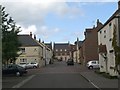
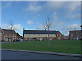
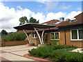
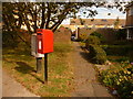
5 photos from this area
Area Information
Key information about the SP7 8RU including its size, population, and administrative classification.
- Area Type
- Postcode
- Area Size
- 9230 m²
- Population
- 1546
- Population Density
- 3657 people/km²
House Prices in SP7 8RU
21
Properties
£263,734
Average Sold Price
£74,500
Lowest Price
£432,500
Highest Price
Showing 21 properties
| Address | Type | Beds | Baths | Last Sale Price | Last Sale Date | |
|---|---|---|---|---|---|---|
| 28 Gower Road, Shaftesbury, SP7 8RU | Detached | 4 | 2 | £417,500 | Nov 2025 | |
| 24 Gower Road, Shaftesbury, SP7 8RU | Detached | 3 | 2 | £320,000 | Mar 2025 | |
| 11 Gower Road, Shaftesbury, SP7 8RU | Semi-detached | 3 | 1 | £275,000 | Jul 2024 | |
| 14 Gower Road, Shaftesbury, SP7 8RU | Detached | 3 | 2 | £392,500 | Sep 2022 | |
| 5 Gower Road, Shaftesbury, SP7 8RU | house | - | - | £272,500 | Sep 2021 | |
| 16 Gower Road, Shaftesbury, SP7 8RU | Semi-detached | 3 | 1 | £241,000 | Mar 2021 | |
| 13 Gower Road, Shaftesbury, SP7 8RU | Semi-detached | 3 | - | £245,000 | Mar 2021 | |
| 26 Gower Road, Shaftesbury, SP7 8RU | house | - | - | £420,000 | Oct 2020 | |
| 12 Gower Road, Shaftesbury, SP7 8RU | Detached | 5 | 2 | £432,500 | Oct 2019 | |
| 22 Gower Road, Shaftesbury, SP7 8RU | Semi-detached | 3 | 2 | £249,000 | Sep 2018 |
Page 1 of 3
Energy Efficiency in SP7 8RU
Amenities
Schools
| Rank | School | Type | Entry gender | Ages |
|---|
Explore more schools in this area
Go to Schools tabDemographics
Household Size
Two person
most common
Accommodation Type
Houses
most common
Tenure
79
majority
Ethnic Group
White
most common
Religion
N/A
most common
Household Composition
N/A
most common
Age
47
median
Adults (30-64 years)
most common
Household Deprivation
N/A
with no deprivation
NS-SEC
34
in Lower managerial occupations
Explore more demographic insights in this area
Go to Demographics tabPlanning
Planning Constraints
- Flood RiskPremium
- Ramsar Wetland SitesPremium
- Area of Outstanding Natural BeautyPremium
- Protected Nature ReservePremium
- Protected WoodlandPremium