Area Overview for SP7 8PR
Photos of SP7 8PR
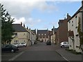
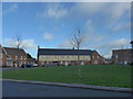
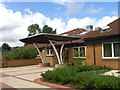
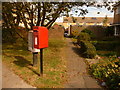
5 photos from this area
Area Information
Key information about the SP7 8PR including its size, population, and administrative classification.
- Area Type
- Postcode
- Area Size
- 2.0 hectares
- Population
- 2014
- Population Density
- 3026 people/km²
House Prices in SP7 8PR
56
Properties
£136,971
Average Sold Price
£38,950
Lowest Price
£230,000
Highest Price
Showing 56 properties
| Address | Type | Beds | Baths | Last Sale Price | Last Sale Date | |
|---|---|---|---|---|---|---|
| 37 Nettlecombe, Shaftesbury, SP7 8PR | Terraced | 3 | 1 | £230,000 | Jan 2025 | |
| 12 Nettlecombe, Shaftesbury, SP7 8PR | Terraced | 3 | 2 | £217,000 | Feb 2024 | |
| 34 Nettlecombe, Shaftesbury, SP7 8PR | Terraced | 3 | 1 | £225,000 | Oct 2023 | |
| 21 Nettlecombe, Shaftesbury, SP7 8PR | Terraced | 3 | 1 | £222,000 | Jul 2023 | |
| 42 Nettlecombe, Shaftesbury, SP7 8PR | house | - | - | £179,000 | Sep 2022 | |
| 41 Nettlecombe, Shaftesbury, SP7 8PR | house | - | - | £220,000 | Aug 2022 | |
| 1 Nettlecombe, Shaftesbury, SP7 8PR | Terraced | 3 | 1 | £193,000 | Aug 2019 | |
| 13 Nettlecombe, Shaftesbury, SP7 8PR | house | 3 | - | £181,000 | Jul 2019 | |
| 6 Nettlecombe, Shaftesbury, SP7 8PR | Terraced | 3 | 1 | £195,000 | Jul 2019 | |
| 30 Nettlecombe, Shaftesbury, SP7 8PR | Terraced | 4 | 1 | £182,500 | Sep 2018 |
Page 1 of 6
Energy Efficiency in SP7 8PR
Amenities
Schools
| Rank | School | Type | Entry gender | Ages |
|---|
Explore more schools in this area
Go to Schools tabDemographics
Household Size
One person
most common
Accommodation Type
Houses
most common
Tenure
55
majority
Ethnic Group
White
most common
Religion
N/A
most common
Household Composition
N/A
most common
Age
47
median
Adults (30-64 years)
most common
Household Deprivation
N/A
with no deprivation
NS-SEC
29
in Lower managerial occupations
Explore more demographic insights in this area
Go to Demographics tabPlanning
Planning Constraints
- Flood RiskPremium
- Ramsar Wetland SitesPremium
- Area of Outstanding Natural BeautyPremium
- Protected Nature ReservePremium
- Protected WoodlandPremium