Area Overview for SP7 8PN
Photos of SP7 8PN
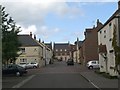
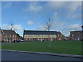
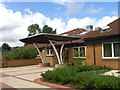
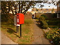
5 photos from this area
Area Information
Key information about the SP7 8PN including its size, population, and administrative classification.
- Area Type
- Postcode
- Area Size
- 1.0 hectares
- Population
- 1819
- Population Density
- 2711 people/km²
House Prices in SP7 8PN
25
Properties
£148,411
Average Sold Price
£55,750
Lowest Price
£271,000
Highest Price
Showing 25 properties
| Address | Type | Beds | Baths | Last Sale Price | Last Sale Date | |
|---|---|---|---|---|---|---|
| 20 Wincombe Lane, Shaftesbury, SP7 8PN | Terraced | 2 | 1 | £208,000 | May 2024 | |
| 10 Wincombe Lane, Shaftesbury, SP7 8PN | Semi-detached | 3 | 1 | £271,000 | Aug 2022 | |
| 12 Wincombe Lane, Shaftesbury, SP7 8PN | house | - | - | £230,000 | Apr 2022 | |
| 23 Wincombe Lane, Shaftesbury, SP7 8PN | Terraced | 3 | - | £193,000 | May 2021 | |
| 4 Wincombe Lane, Shaftesbury, SP7 8PN | Terraced | 2 | 1 | £195,000 | Jan 2018 | |
| 22 Wincombe Lane, Shaftesbury, SP7 8PN | Terraced | 2 | 1 | £117,500 | Jun 2013 | |
| 37 Wincombe Lane, Shaftesbury, SP7 8PN | house | 3 | 1 | £135,000 | Feb 2010 | |
| 39 Wincombe Lane, Shaftesbury, SP7 8PN | house | 3 | - | £128,000 | Nov 2004 | |
| 29 Wincombe Lane, Shaftesbury, SP7 8PN | Semi-detached | - | - | £150,000 | Oct 2004 | |
| 16 Wincombe Lane, Shaftesbury, SP7 8PN | house | - | - | £137,500 | Jul 2004 |
Page 1 of 3
Energy Efficiency in SP7 8PN
Amenities
Schools
| Rank | School | Type | Entry gender | Ages |
|---|
Explore more schools in this area
Go to Schools tabDemographics
Household Size
Two person
most common
Accommodation Type
Houses
most common
Tenure
66
majority
Ethnic Group
White
most common
Religion
N/A
most common
Household Composition
N/A
most common
Age
47
median
Adults (30-64 years)
most common
Household Deprivation
N/A
with no deprivation
NS-SEC
26
in Lower managerial occupations
Explore more demographic insights in this area
Go to Demographics tabPlanning
Planning Constraints
- Flood RiskPremium
- Ramsar Wetland SitesPremium
- Area of Outstanding Natural BeautyPremium
- Protected Nature ReservePremium
- Protected WoodlandPremium