Area Overview for SP7 8NS
Photos of SP7 8NS
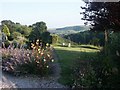
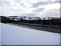
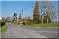
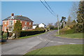
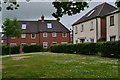
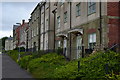
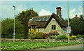

26 photos from this area
Area Information
Key information about the SP7 8NS including its size, population, and administrative classification.
- Area Type
- Postcode
- Area Size
- 2.0 hectares
- Population
- 1597
- Population Density
- 719 people/km²
House Prices in SP7 8NS
18
Properties
£204,883
Average Sold Price
£49,500
Lowest Price
£280,000
Highest Price
Showing 18 properties
| Address | Type | Beds | Baths | Last Sale Price | Last Sale Date | |
|---|---|---|---|---|---|---|
| 6 Butts Mead, Shaftesbury, SP7 8NS | Bungalow | 2 | 1 | £273,100 | Aug 2023 | |
| 9 Butts Mead, Shaftesbury, SP7 8NS | Bungalow | 2 | 1 | £267,000 | Sep 2021 | |
| 16 Butts Mead, Shaftesbury, SP7 8NS | Bungalow | 3 | 1 | £280,000 | Jun 2020 | |
| 10 Butts Mead, Shaftesbury, SP7 8NS | Bungalow | 3 | 2 | £220,000 | Aug 2019 | |
| 3 Butts Mead, Shaftesbury, SP7 8NS | Bungalow | - | - | £270,000 | Nov 2015 | |
| 7 Butts Mead, Shaftesbury, SP7 8NS | Bungalow | - | - | £131,000 | Feb 2014 | |
| 18 Butts Mead, Shaftesbury, SP7 8NS | Bungalow | - | - | £260,000 | Jan 2014 | |
| 15 Butts Mead, Shaftesbury, SP7 8NS | Bungalow | 3 | - | £215,000 | Dec 2013 | |
| 14 Butts Mead, Shaftesbury, SP7 8NS | Bungalow | 3 | - | £197,000 | Jan 2013 | |
| 13 Butts Mead, Shaftesbury, SP7 8NS | Bungalow | 2 | - | £200,000 | Nov 2010 |
Page 1 of 2
Energy Efficiency in SP7 8NS
Amenities
Schools
| Rank | School | Type | Entry gender | Ages |
|---|
Explore more schools in this area
Go to Schools tabDemographics
Household Size
Two person
most common
Accommodation Type
Houses
most common
Tenure
76
majority
Ethnic Group
White
most common
Religion
N/A
most common
Household Composition
N/A
most common
Age
47
median
Elderly (65+ years)
most common
Household Deprivation
N/A
with no deprivation
NS-SEC
41
in Lower managerial occupations
Explore more demographic insights in this area
Go to Demographics tabPlanning
Planning Constraints
- Flood RiskPremium
- Ramsar Wetland SitesPremium
- Area of Outstanding Natural BeautyPremium
- Protected Nature ReservePremium
- Protected WoodlandPremium