Area Overview for SP7 0LF
Photos of SP7 0LF
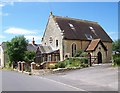
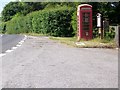
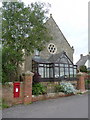
9 photos from this area
Area Information
Key information about the SP7 0LF including its size, population, and administrative classification.
- Area Type
- Postcode
- Area Size
- 19.4 hectares
- Population
- 1852
- Population Density
- 51 people/km²
House Prices in SP7 0LF
12
Properties
£420,071
Average Sold Price
£60,500
Lowest Price
£765,000
Highest Price
Showing 12 properties
| Address | Type | Beds | Baths | Last Sale Price | Last Sale Date | |
|---|---|---|---|---|---|---|
| All Set, Parsons Lane, Hartgrove, SP7 0LF | Semi-detached | - | - | £485,000 | Nov 2022 | |
| Fairview, Parsons Lane, Hartgrove, SP7 0LF | Mobile Home | - | - | £60,500 | Nov 2021 | |
| Hill Lawn, Parsons Lane, Hartgrove, SP7 0LF | Bungalow | - | - | £765,000 | Jun 2021 | |
| Highland, Parsons Lane, Hartgrove, SP7 0LF | Semi-detached | 5 | 2 | £460,000 | Jun 2021 | |
| Hillyfields, Parsons Lane, Hartgrove, SP7 0LF | Bungalow | 3 | - | £355,000 | Oct 2014 | |
| Linden Lea, Parsons Lane, Hartgrove, SP7 0LF | house | - | - | £365,000 | Oct 2010 | |
| The Old Chapel, Parsons Lane, Hartgrove, SP7 0LF | Detached | - | - | £450,000 | Jun 2003 | |
| Crockers, Parsons Lane, Hartgrove, SP7 0LF | Land | - | - | - | - | |
| Clouds Hill, Parsons Lane, Hartgrove, SP7 0LF | Detached | 3 | 2 | - | - | |
| Chestnut Cottage, Parsons Lane, Hartgrove, SP7 0LF | Semi-detached | - | - | - | - |
Page 1 of 2
Energy Efficiency in SP7 0LF
Amenities
Schools
| Rank | School | Type | Entry gender | Ages |
|---|
Explore more schools in this area
Go to Schools tabDemographics
Household Size
Two person
most common
Accommodation Type
Houses
most common
Tenure
82
majority
Ethnic Group
White
most common
Religion
N/A
most common
Household Composition
N/A
most common
Age
47
median
Adults (30-64 years)
most common
Household Deprivation
N/A
with no deprivation
NS-SEC
37
in Lower managerial occupations
Explore more demographic insights in this area
Go to Demographics tabPlanning
Planning Constraints
- Flood RiskPremium
- Ramsar Wetland SitesPremium
- Area of Outstanding Natural BeautyPremium
- Protected Nature ReservePremium
- Protected WoodlandPremium