Area Overview for SP7 0HQ
Photos of SP7 0HQ
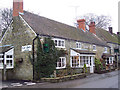
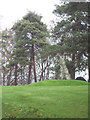
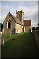
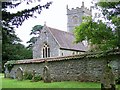
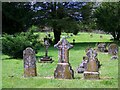
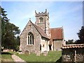
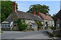
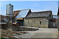
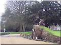
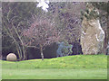
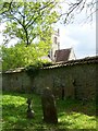
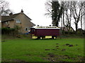
69 photos from this area
Area Information
Key information about the SP7 0HQ including its size, population, and administrative classification.
- Area Type
- Postcode
- Area Size
- 29.4 hectares
- Population
- 2006
- Population Density
- 29 people/km²
House Prices in SP7 0HQ
12
Properties
£510,000
Average Sold Price
£120,000
Lowest Price
£1,140,000
Highest Price
Showing 12 properties
| Address | Type | Beds | Baths | Last Sale Price | Last Sale Date | |
|---|---|---|---|---|---|---|
| Cradle House, Luke Street, Berwick St John, SP7 0HQ | Detached | 4 | 2 | £1,140,000 | Sep 2024 | |
| Huberts House, Luke Street, Berwick St John, SP7 0HQ | house | - | - | £750,000 | Aug 2017 | |
| Leigh Cottage, Luke Street, Berwick St John, SP7 0HQ | Detached | 3 | - | £499,999 | Jun 2013 | |
| Ridgeway House, Luke Street, Berwick St John, SP7 0HQ | house | - | - | £280,000 | Sep 1998 | |
| Appletrees, Luke Street, Berwick St John, SP7 0HQ | Detached | 4 | 2 | £270,000 | Jul 1998 | |
| Chapel House, Luke Street, Berwick St John, SP7 0HQ | Detached | - | - | £120,000 | Jul 1997 | |
| Sheres Barn, Luke Street, Berwick St John, SP7 0HQ | Detached | 4 | 2 | - | - | |
| Home Crest, Luke Street, Berwick St John, SP7 0HQ | Detached | - | - | - | - | |
| Barnhouse, Luke Street, Berwick St John, SP7 0HQ | Detached | - | - | - | - | |
| Dairy House Farm, Luke Street, Berwick St John, SP7 0HQ | house | 4 | - | - | - |
Page 1 of 2
Energy Efficiency in SP7 0HQ
Amenities
Schools
| Rank | School | Type | Entry gender | Ages |
|---|
Explore more schools in this area
Go to Schools tabDemographics
Household Size
Two person
most common
Accommodation Type
Houses
most common
Tenure
70
majority
Ethnic Group
White
most common
Religion
N/A
most common
Household Composition
N/A
most common
Age
47
median
Adults (30-64 years)
most common
Household Deprivation
N/A
with no deprivation
NS-SEC
40
in Lower managerial occupations
Explore more demographic insights in this area
Go to Demographics tabPlanning
Planning Constraints
- Flood RiskPremium
- Ramsar Wetland SitesPremium
- Area of Outstanding Natural BeautyPremium
- Protected Nature ReservePremium
- Protected WoodlandPremium