Area Overview for SP6 3DL
Photos of SP6 3DL
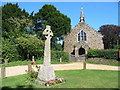

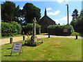
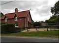
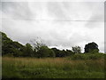
50 photos from this area
Area Information
Key information about the SP6 3DL including its size, population, and administrative classification.
- Area Type
- Postcode
- Area Size
- 29.1 hectares
- Population
- 2160
- Population Density
- 32 people/km²
House Prices in SP6 3DL
14
Properties
£449,495
Average Sold Price
£170,000
Lowest Price
£690,000
Highest Price
Showing 14 properties
| Address | Type | Beds | Baths | Last Sale Price | Last Sale Date | |
|---|---|---|---|---|---|---|
| Pittswood, Daggons Road, Alderholt, SP6 3DL | Detached | - | - | £350,000 | Mar 2025 | |
| Sandcroft, Daggons Road, Alderholt, SP6 3DL | house | - | - | £535,000 | Jan 2021 | |
| The Red House, Daggons Road, Alderholt, SP6 3DL | Detached | 3 | 3 | £690,000 | Jul 2019 | |
| Mero, Highwood Close, Alderholt, SP6 3DL | Bungalow | 4 | 2 | £485,000 | Dec 2016 | |
| Greenhayes, Highwood Close, Alderholt, SP6 3DL | Bungalow | 4 | - | £450,000 | Jun 2016 | |
| Treetops, Highwood Close, Alderholt, SP6 3DL | Bungalow | - | - | £550,000 | Feb 2016 | |
| Birch Hill, Daggons Road, Alderholt, SP6 3DL | house | - | - | £600,000 | Jun 2007 | |
| Glenmere, Daggons Road, Alderholt, SP6 3DL | Detached | 5 | - | £395,000 | Jan 2003 | |
| South Lodge, Daggons Road, Alderholt, SP6 3DL | Detached | - | - | £269,950 | Jun 2002 | |
| Little Orchard, Daggons Road, Alderholt, SP6 3DL | house | - | - | £170,000 | Dec 1996 |
Page 1 of 2
Energy Efficiency in SP6 3DL
Amenities
Schools
| Rank | School | Type | Entry gender | Ages |
|---|
Explore more schools in this area
Go to Schools tabDemographics
Household Size
Two person
most common
Accommodation Type
Houses
most common
Tenure
56
majority
Ethnic Group
White
most common
Religion
N/A
most common
Household Composition
N/A
most common
Age
47
median
Adults (30-64 years)
most common
Household Deprivation
N/A
with no deprivation
NS-SEC
34
in Lower managerial occupations
Explore more demographic insights in this area
Go to Demographics tabPlanning
Planning Constraints
- Flood RiskPremium
- Ramsar Wetland SitesPremium
- Area of Outstanding Natural BeautyPremium
- Protected Nature ReservePremium
- Protected WoodlandPremium